
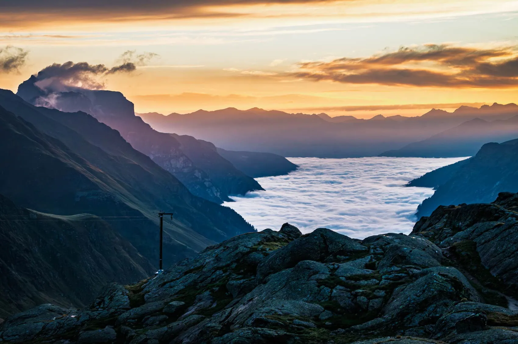
The Stubai High Trail is the hut-to-hut route against which all other high-altitude trails in the Eastern Alps must be measured: seven stages, eight catered mountain huts, around 80 kilometres and roughly 4,400 metres of elevation gain, almost continuously above the 2,000-metre line. Along the way, you circumnavigate the rear Stubai Valley in a wide arc, with the glaciated Stubai Alps constantly in view. I walked this complete circuit in August 2015, taking nine days including the summit of the Habicht, and to this day it holds a permanent place in my personal best-of list.
The beauty of it is: you don't need a tent, sleeping bag, or stove. The huts provide beds and kitchens, so your backpack stays small. That's precisely why this tour is perhaps the best introduction to multi-day lightweight mountain hiking, and at the same time challenging enough that experienced alpine hikers won't get bored.
In this guide, you'll find all the stages with verified figures, the reservation logic for the huts, an honest assessment of the difficulty, and a packing list that will keep you under 5 kilos on your back, including water and snacks.
The Stubai High Trail at a glance
The key milestones, before we delve into the details:
| Key data | Value |
|---|---|
| Stages (hut to hut) | 7 |
| Cabins | 8 (all ÖAV/DAV) |
| Distance (excluding ascent and descent) | ~80 km |
| Metres of ascent | ~4.440 m |
| Metres of descent | ~4.230 m |
| Highest point | Grawagrubennieder, ~2,880 m |
| Difficulty | Black Mountain Path, SAC T2 to T3 |
| Season | Early July to mid-September |
| Total duration including ascent and descent | 8 to 9 days |
The path connects the eight huts in the rear Stubai valley into a circuit that you can walk in either direction. All huts are situated between roughly 2,100 and 2,400 metres, so you can stay up high for days without having to descend into the valley. And if something unforeseen should occur: a descent into the Stubai valley leads from each individual hut.
The seven stages of the Stubaier Höhenweg
The official stage data from the tourist board, anti-clockwise starting from the Starkenburger Hütte. Individual distance and elevation gain figures vary slightly depending on the source, hence the tilde:
| Stage | Walking time / Distance | Character |
|---|---|---|
| Starkenburger Hütte to Franz-Senn-Hütte (~15 km, ~690 m ascent) | Roughly 7 hours | Long high-level crossing to acclimatise, many small ups and downs. |
| 2. Franz-Senn-Hütte → Neue Regensburger Hütte (~9 km, ~600 m ascent) | About 4 hours | Short and sweet about the Schrimmennieder. |
| 3. Neue Regensburger Hütte → Dresdner Hütte (~13 km, ~1,030 m ascent) | Roughly 7 hours | Queen stage over the Grawagrubennieder, the highest point of the tour. |
| 4. Dresdner Hütte → Sulzenauhütte (~5 km, ~420 m elevation gain) | Around 3 hours | Short stage over the Peiljoch, time for breaks or a summit. |
| 5. Sulzenauhütte → Nürnberger Hütte (~4.4 km, ~460 m ascent) | About 4 hours | Short and scenically grand: Grünausee and glacier views. |
| 6. Nürnberger Hütte to Bremer Hütte (~6 km, ~640m ascent) | About 4 hours | Block terrain and rope-secured sections. |
| 7. Bremer Hütte → Innsbrucker Hütte (~9.5 km, ~840 m ascent) | Roughly 7 hours | Long, exposed final section over the Trauljöchl. |
The ascent: Neustift to Starkenburger Hütte
The tour itself only begins at the top, so you have to head up on the first day: from Neustift to the Starkenburger Hütte there are around 1,270 metres of ascent, taking about 4 hours. Those wanting to save energy can take the cable car up to the Kreuzjoch (Schlick 2000 from Fulpmes) and traverse from there to the hut in considerably less time. Not a bad move, as the first real stage the following day is one of the longest.

Stage 3: The King Stage across the Grawagrubennieder
The route from the Neue Regensburger Hütte initially leads comfortably along the Hohes Moos to the Falbesoner See, then it gets serious: the ascent to the Grawagrubennieder at around 2,880 metres leads through blocky terrain, where you'll occasionally need to take your hands out of your pockets. Early in the season, there are often still snowfields here. The descent takes you into the ski area around the Dresdner Hütte, a small culture shock after two days of solitude, but with the comfort of a large, well-equipped hut.
Stage 7: the long finale
Get up early at the Bremer Hütte: In 2015, I was standing outside the door at six in the morning at 3 degrees, while the others were still in their sleeping bags. Below me was a sea of clouds in the valley, and above me, the first ray of sun. It doesn't get any quieter in the Alps.
The final stage to the Innsbrucker Hütte is once again the full works: around 7 hours, exposed traverses, cable-secured sections and the Trauljöchl as the final pass. Many underestimate this stage because the destination seems so close. Plan it like a queen stage. As a reward, the Innsbrucker Hütte stands right at the foot of the Habicht, more on that in a moment.

Bonus Summit: The goshawk
If you plan an extra night at the Innsbrucker Hütte, the 3,277-metre-high Habicht is right on your doorstep: an easy high-altitude tour with secured passages, simple climbing sections (UIAA I) and an exposed ridge, with no glacier contact. In 2015, I set off from the hut at half past seven and, a few hours later, I was standing at a higher altitude than I had ever stood on foot before, with views all the way to the Dolomites. I learned two things from this: firstly, it’s better to go on a weekday, as it gets crowded at the climbing sections on Saturdays. And secondly, it really is worth staying overnight at the hut afterwards, rather than descending the good 1,300 metres to Neustift on the same day.

The descent
From the Innsbrucker Hütte you descend through the Pinnistal valley to Neder, from where the bus takes you back to Neustift. Alternatively, you can stop off in the Pinnistal valley and celebrate the finish. You've earned it.

Direction, entry and escape routes
Most people walk the Stubai High Trail anticlockwise, starting from the Starkenburger Hütte. The arguments in favour of this are: the long first stage is easier to digest when you are fresh, and the ascents to the passes are generally distributed a bit more mercifully in this direction. Clockwise from the Innsbrucker Hütte, the route works just as well, only with the hardest stage right at the beginning.
Because every hut has a descent to the valley, you can shorten, interrupt or get out of the circuit at almost any point. Particularly practical: the Dresdner Hütte has the Stubaier Gletscherbahnen cable car, which allows you to conveniently get back to the valley in an emergency or if the weather turns. For those with only three or four days, you can walk a section and descend where it suits. The bus service in the valley will pick you up again. Conversely, you can also condense the circuit: the short middle stages can easily be combined. In 2015, I combined two of them and invested the extra day in climbing the Habicht.
How difficult is the Stubai High Trail really?
Officially, the route is classified as a black mountain trail, and on the SAC scale, most of it ranges between T2 and T3. Translated, this means: well-marked, but alpine paths with boulder fields, exposed traverses, and isolated cable-secured sections. A sure foot and a head for heights are the honest prerequisites here.
What you DO NOT need: via ferrata set, crampons, glacier experience. The path does not cross any glacier. What can be useful early in the season: light ice grippers for the old snow fields at the crossings, especially at the Grawagrubennieder. Most of the fields are gone by mid-July, a call to the nearest hut will give you up-to-date information.
Conditionally, you should be able to cope with walking times of up to 7 hours with around 1,000 metres of ascent for several days in a row. Those who can easily manage this in low mountain ranges with a day pack will also manage it here, provided the rucksack remains light. That's exactly where the packing list section below comes in.
Huts and Reservations: How it Works
All eight huts on the tour are Alpine Club huts (ÖAV or DAV) with dormitories and in some cases small rooms, catered from early July until September. The order of the tour in an anti-clockwise direction: Starkenburger Hütte, Franz-Senn-Hütte, Neue Regensburger Hütte, Dresdner Hütte, Sulzenauhütte, Nürnberger Hütte, Bremer Hütte, Innsbrucker Hütte.
The most important sentence in this section: book early. The Stubaier Höhenweg is popular, and smaller huts like the Bremer Hütte in particular fill up quickly on summer weekends. Those planning to go in July or August should ideally plan in the spring and book all huts in advance. Without a reservation, you won't get a guaranteed place to sleep.
Regarding the budget: for Alpine Club members, the mattress dorm costs around €15 thanks to tariff agreements, while non-members pay at least €12 more per night. Add to this half-board (around €35 to €45 depending on the hut) and drinks. Realistically, you'll be looking at around €80 to €100 per hut day. For seven nights, membership in the Alpine Club (around €60 to €90 per year depending on the section) will have almost paid for itself through the overnight stay discounts, not to mention the cheaper mountain climber's meal and the included rescue costs insurance. A sleeping bag liner is mandatory in all Alpine Club huts.
The best time for the Stubaier Höhenweg
The window of opportunity is shorter than many think: early July to mid-, at the latest, end of September. Before then, snowfields block the high passes, and afterwards, the mountain huts close. Within this window, the following applies:
In July you have the longest days and blooming alpine meadows, but also the highest probability of old snow on the north-facing slopes of the cols. August is the most reliably snow-free, but the huts are busiest and the propensity for thunderstorms is highest. September is our favourite: stable high-pressure systems, sparse crowds, clear long-distance views. However, the days are getting shorter, and an early onset of winter is never ruled out. Regardless of the month: afternoon thunderstorms are standard fare in the Stubai Alps, start early and be past the exposed sections by midday.
And mentally plan that not every week is a postcard week. The first half of my round in August 2015 consisted of rain, fog, overflowing streams and dry rooms where half huts were piled up. The rain jacket was by far the most important item in my backpack that week. I wouldn't have swapped it for a single day, though.

Packing List: Under 5 kilos on your back
Now to the part where, as a manufacturer, we naturally have the most to say. The standard recommendation for the Stubaier Höhenweg is „a maximum backpack weight of 10 kilos“. That is correct as an upper limit, but far too high as a target. A hut-to-hut tour is the simplest case of lightweight hiking: tent, sleeping bag, sleeping mat and stove stay completely at home. What remains weighs barely more than 2 kilos when put on the scales.
Here's the complete setup with realistic weights. Clothing, shoes, and sticks worn are not counted, as you have them on your person:
| Item | Weight | Manufacturer's comment |
|---|---|---|
| WeitLäufer Agilist (2026, Size M) | 570g | The taped 40L main compartment replaces rain cover and pack liner. |
| Rain jacket (2.5-layer laminate) | approx 180 g | Must always be to hand, weather can turn here quickly. |
| Insulation jacket (down or synthetic) | ~230g | For breaks at the saddle and the evening on the mountain hut terrace. |
| Spare shirt (Merino, long-sleeved) | 150g | Lounge top and pyjama top in one. |
| Spare socks (Merino) | ~50 g | |
| Beanie + thin gloves | ~60 g | At 2,800 metres, it can snow even in August. |
| Buff | 35 g | |
| Silk sleeping bag liner | ~110 g | Mandatory on all Alpine Club huts. Silk instead of cotton saves a good 100 g. |
| Microfibre towel | ~40 g | |
| Earplugs | ~5 g | The 5 most important grams in the mattress industry. |
| Hygiene + First Aid (Minimal) | approx 180 g | Compeed generously, the rest consistently cleared out. |
| Headlamp | ~28g | For early starts and the walk to the camp after lights out. |
| Powerbank 10,000 mAh + Cable | ~195 g | Sockets are in short supply in mountain huts. |
| Water filter (e.g. Katadyn BeFree) | ~59 g | There are plenty of streams, so you'll save yourself expensive hut water. |
| 2 PET bottles of 1 L | ~56g | A 2-litre capacity was enough for me for the whole lap, refilling at streams and huts. |
| Sun cream (30 ml) | 35 g | Non-negotiable at 2,500m. |
| Post office | Weight |
|---|---|
| Core setup (base weight including rucksack) | ~2.0 kg |
| Grindel (optional, early in the season) | 0.25 kg |
| Water (1.5 L, refillable at streams) | 1.5 kg |
| Snacks for the day | 0.5 kg |
| ALL OF IT ON THE BACK | ~4.3 kg |
Under 5 kilos, with everything. The difference from the usual 10 kilos is not a question of comfort on this route: in the boulder fields at the Grawagrubennieder and on the exposed traverses of the final stage, a lighter rucksack means better balance and safer footing.

Travel and Logistics
The Stubai High Trail is delightfully accessible by public transport. You take the train to Innsbruck and change there to bus 590, which takes you to Neustift im Stubaital in around 40 minutes. The approach to the Starkenburger Hut starts directly from the centre of the village. If you come by car, you park in Neustift, and after the tour the bus brings you the few kilometres back from the descent point in Neder to the starting point.
And take enough cash with you: not every hut takes cards, and there are no cash machines up there.
Frequently asked questions about the Stubai High Trail
The Stubai High Trail is a black mountain path, predominantly T2 to T3 on the SAC scale. You need a sure foot, a head for heights and fitness for up to 7 hours of walking per day. A via ferrata set or crampons are not necessary; the key sections are secured with ropes.
The tour consists of 7 hut-to-hut stages. You should plan for 8 to 9 days, including the ascent from Neustift to the Starkenburger Hütte and the descent from the Innsbrucker Hütte. Thanks to valley descents from every hut, the tour can also be divided into shorter sections.
Early July to mid-September, as long as the mountain huts are open and staffed. Early in the season, there are often still snowfields on the high passes, in which case light crampons are advisable. September generally offers the most stable conditions and the emptiest beds.
Yes, absolutely and as soon as possible. All eight huts are Alpine Club huts with mandatory reservations, many are booked up weeks in advance during peak season. Most can be booked centrally via hut-reservation.org To book.
Budget around.
Small. With the tent, sleeping bag and stove omitted, the complete mountain hut tour luggage fits easily into 30 to 40 litres. More important than the volume is the weight: with a consistent packing list like the one above, you'll stay under 5 kg, including water and snacks.
Next step: planning your tour
You now have everything you need for planning: the stages, the reservation logic, the time frame and a packing list that will get you safely and lightly over the mountain ridges. The most sensible next step is to set your desired time frame and book the huts; everything else will follow from that.
And if your current backpack is more suited to trekking tours than high-altitude paths: the Agilist is our suggestion for exactly this kind of tour. 570 g, taped seams on the main compartment, and rolled down small – exactly the hut-to-hut tour format that makes all the difference on the Stubai High Trail.