
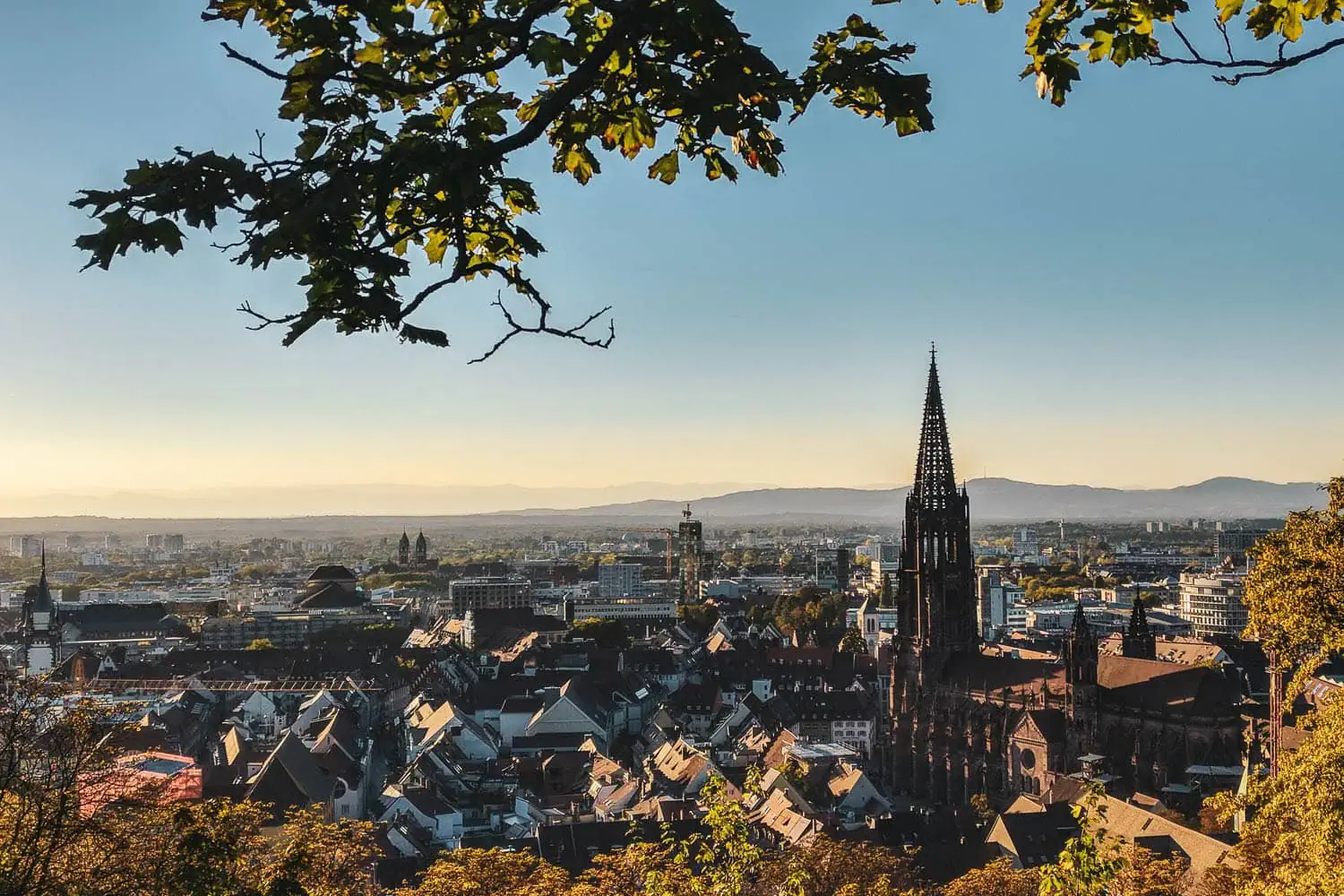
Freiburg is one of the few German cities where „just popping out for a hike“ is meant literally. No travel time, no traffic jams, no hunting for a space at the trailhead. Tram to the terminus, twenty minutes later you're in the forest, and after a two-hour ascent you're looking out over half the Rhine Valley.
This guide introduces eight routes that I have walked myself, with the exact figures that are missing from most Freiburg lists: length, elevation gain separated by ascent and descent, walking time, and the return journey by bus or train. Plus the question that is on no hiking website: What actually belongs in the rucksack, and what does it weigh?
Why hiking works differently in Freiburg
The historic old town of Freiburg lies at 278 metres above sea level. The Schauinsland, the city's local mountain, at 1,284. That is a difference of a good thousand vertical metres, and the mountain does not start somewhere behind the motorway, but extends right into the urban area.
This figure is the whole point. A thousand vertical metres is the scale of a proper Alpine day stage. The journey here: a two-zone ticket.
I moved here at the beginning of 2018, straight after four months of walking from Vienna to Nice. After a tour like that, I don't get a slump of exhaustion. I get withdrawal. From the Rhineland, it took hours of travelling to reach the mountains every time, and that was exactly what I wanted to get rid of.

The side effect is unspectacular and yet makes all the difference: I've been lacing up my hiking boots significantly more often ever since. The reason is simple: the hurdle is gone. An after-work hike that starts at 5 pm and ends at 9 pm with a beer in the old town actually works here.
Our workshop is located in Emmendingen, a good twenty kilometres north of Freiburg on the edge of the Elz valley. The territory in this article is not a researched travel destination for us, but rather the terrain where every prototype has been clocking up its first kilometres for years.
The three walking worlds around Freiburg
Anyone searching for „hiking in Freiburg“ usually gets an unordered list of thirty routes. Yet the region divides very neatly into three zones, and the choice between them determines the entire day: travel time, elevation gain, temperature, and whether you will find water along the way.
| Zone | Altitude | Character and directions |
|---|---|---|
| Urban mountains: Schlossberg, Rosskopf, Schönberg, Kybfelsen | 400 to 800 m | Directly accessible from the city on foot or by tram. Perfect after-work terrain, plenty of places to stop for food and drink, shady enough in midsummer. |
| High Black Forest: Schauinsland, Belchen, Feldberg | 1,200 to 1,500 m | 20 to 60 minutes by bus or Höllentalbahn. Proper mountain day hikes with 800 to 1,200 metres of elevation gain, with reliable snow in winter. |
| Kaiserstuhl and Rhine Plain | up to 557 m | 25 minutes on the Breisgau S-Bahn. Vineyards, sunken loess paths, open sun. Perfect in March and April, the worst idea in the region in July. |
The practical rule that follows from this: In spring it's off to the west, in summer up high, in autumn everywhere and in winter to the Schauinsland. Tour planning here doesn't actually need any more system.

Hiking Schauinsland: the local mountain in detail
The Schauinsland is the answer to most Freiburg hiking questions, and it has the rare advantage that you can play it from both sides: up on foot and down by cable car, or vice versa.
The Schauinsland cable car travels from Horben up the mountain in around twenty minutes, overcoming an altitude difference of 746 metres over a route length of 3,600 metres, making it Germany's longest continuous-movement ropeway.[1] It has been in operation since 1930, which suits it in a very pleasant way.
Walking up: the honest way
From the valley station, it is 6.7 kilometres and 817 vertical metres to the summit, taking two and a half to three hours. This is the most compact option and at the same time the steepest. Anyone setting off from the Wiehre district instead has ten rather leisurely kilometres ahead of them, before tackling around 400 vertical metres in one go on the final stretch.
At the top stands the observation tower, and on a clear day you can see the Alps from there. That's simply a matter of the weather: it works most reliably in winter during an inversion, when the Rhine Valley lies beneath a blanket of fog and the air above it is dry and clear.
Walking down: the underrated direction
The descent via the Kybfelsen back to Freiburg is the most scenic route and the one where most people have aching muscles the next day: 13.3 kilometres and 1,075 metres of descent. Going downhill sounds harmless, but it's the strain that knees and the forefoot really feel. If you notice along the way that you're landing on your heel with every step, you've still got a long way to go.
A warning I should have given myself: the mountain has winter, even when the city doesn't. I set out in January on ice-free roads and stood at the top in fifty centimetres of snow. There is a difference in altitude of almost a kilometre between the valley station and the summit, and that reliably separates two seasons.

Eight tours around Freiburg with real figures
These are eight routes that I've walked myself and recorded with GPS. Sorted from the short after-work circuit to the long day trip. All elevation figures state the direction that shapes the day, because around Freiburg almost every good tour is a point-to-point hike with a distinct bias.
| Tour | Route | Walking time and character |
|---|---|---|
| Schauinsland from the valley station | 6.7 km / 817 m elevation gain | 2.5 to 3 hours. The direct ascent to the local mountain, steep all the way. Return journey by cable car possible. |
| Schönberg from St. Georgen | 9.2 km / 357 m ascent | 3 hrs. The classic after-work ride with panoramic views of the Belchen, Schauinsland and the Vosges. Stop for refreshments at the Schönebergerhof. |
| To the Waldtraut from Günterstal | 11.3 km / 384 m elevation gain | 3 to 3.5 hours. Easy forest walk to Germany's tallest tree. Family-friendly, well signposted. |
| Schauinsland via the Kybfelsen to Freiburg | 13.3 km / 1,075 m ascent | 3.5 hours. Long descent with views of the rock over the town. Finishes right in the old town, no return journey necessary. |
| Gundelfingen via the Rosskopf to Freiburg | 14.3 km / 527 m elevation gain | 4.5 hours. Outbound by S-Bahn (7 minutes), back on foot as far as the Schwabentor. Sunset at the Kanonenplatz as a bonus. |
| Schauinsland to the Münstertal | 14.9 km / 846 m descent | 4.5 hours. Scenic descent with a view of the 1,414-metre-high Belchen. Return by S-Bahn via Bad Krozingen. |
| Freiburg via the Rosskopf to St. Peter | 18.4 km / 773 m ascent | 6 h. From Schwabentor on the Kandelhöhenweg into the High Black Forest village of St. Peter. Return journey by bus via Kirchzarten. |
| Feldberg to Kirchzarten | 21 km / 1,262 m descent | 6 to 7 hours. The most demanding of the eight. Via Baldenweger Hütte and Hinterwaldkopf, very varied, but long. |

Schauinsland from the valley station
6.7 km, 817 m ascent, 2.5 to 3 hours. Start at the valley station of the Schauinslandbahn cable car at 460 metres, highest point 1,277 metres.
The shortest route to the summit and at the same time the steepest. It goes uphill almost the whole way, with the Schauinslandstraße being crossed only once briefly. The quality of the path is remarkable: around 80 percent of the route consists of narrow paths and natural trails, with gravel found on just over a kilometre. For an ascent of this length that is rare, as you usually end up stuck on a forest track halfway up. If you want to save yourself the walk back down, you can take the cable car to the valley, making this the most compact half-day trip in the region. View track

2. Schönberg from St. Georgen
9.2 km, 357 m ascent, around 3 hours. Circular tour starting from St. Georgen, summit at 633 metres.
From St. Georgen, the route leads past the vineyards towards Leutersberg, then along a narrow path via the former Schneeburg and the lower Schönbergerhof to the summit. The return route goes via the east side. This is the after-work walk: short, accessible by bus and train, and with a panoramic view that is almost cheekily good for the effort involved. To the west, the Vosges; to the east, the Schauinsland and Belchen. Stop for refreshments at the Schönebergerhof. One reservation: the Schönberg stands isolated in the Rhine Plain and has hardly any shade. On a hot July day it is the wrong choice, in October the right one. View track
3. To Waldtraut from Günterstal
11.3 km, 384 m elevation gain, 3 to 3.5 hours. Circular tour starting from the Wonnhalde stop.
Via forest and woodland paths to the highest tree in Germany and onwards to Langackern, from where the view stretches as far as the Vosges. The Waldtraut vom Mühlwald is a Douglas fir, planted in 1913, last measured at 67.85 metres and still growing.[2] It stands quite unspectacularly on the hillside, and that is precisely the appeal: no visitor centre, no admission fee, just a signpost. The easiest of the eight routes, well-signposted, manageable with children, and because it is a loop, you don't need a return plan. View track
4. Schauinsland via the Kybfelsen to Freiburg
13.3 km, 1,075 m descent, 3.5 hours. Up with the cable car, only on foot downhill, destination is the old town.
The most scenic option and the one that is most underestimated. On paper it is a descent, in the legs the next day it is not. Over a thousand vertical metres downhill place more strain on the knees and forefoot than the same amount uphill, and the bill arrives late. The Kybfelsen, roughly halfway up, is the highlight: a rocky pulpit with a view across the city all the way to the Vosges. After that, the path becomes narrow and rocky in places, and correspondingly slippery when wet. The best comes last: the tour ends in the old town, and you don't need a return journey at all.

5. Gundelfingen via the Rosskopf to Freiburg
14.3 km, 527 m ascent and 488 m descent, 4.5 hours. From 242 to 731 metres, start Gundelfingen station, destination Freiburg Old Town.
Seven minutes on the S-Bahn to the north, then back on foot. Via the scenic Wildtalereck, the route leads to the Rosskopf, where the Friedrichsturm stands—a 34-metre-high steel framework tower dating from 1889 and to this day the most popular meeting place for Freiburg's hikers and mountain bikers.[3] From there, the trail follows the Kandelhöhenweg via the Kanonenplatz down into the Old Town. Anyone who times the last section right will be sitting at the Kanonenplatz above the rooftops for the sunset. For me, it's the complete round trip: there by train, back on foot, and the destination is your own front door. View track
6. Schauinsland to the Münstertal
14.9 km, 846 m descent, 4.5 hours. Descent to the south, back by train via Bad Krozingen, around 40 minutes.
The quieter version of the Schauinsland descent. Instead of heading back to the city, the route leads south into the Münstertal, with the 1,414-metre-high Belchen almost constantly in view. Those who want to hike up the Belchen themselves later get a preview from the best perspective here. Down in the Münstertal, you board the train and return to Freiburg via Bad Krozingen. This tour reveals a side of the Upper Black Forest that is much less trodden than anything around the summit area.

7. Freiburg via the Rosskopf to St. Peter
18.4 km, 773 m ascent and 328 m descent, 6 hours. Start Schwabentor, destination St. Peter at 716 metres, return by bus via Kirchzarten.
The only one of the eight tours that leads out of the city into the Upper Black Forest instead of back into it. From the Schwabentor gate along the Kandelhöhenweg trail via the Rosskopf and further east. The second part is the quieter one: fewer panoramic views, more forest, but with a destination that makes the walking worthwhile. Anyone considering the Kandelhöhenweg as a multi-day tour in the future already has the first stage under their belt with this one. It is important to check the bus timetable here, as this is the tour with the longest journey back.

8. Feldberg to Kirchzarten
21 km, 412 metres of ascent and 1,262 metres of descent, 6 to 7 hours. Get there by the Höllentalbahn and bus; return from Kirchzarten.
The most challenging and the longest. From the highest point in the Black Forest, the route winds back down into the Dreisam Valley in a wide arc: via the Baldenweger Hütte, the Hinterwaldkopf with its view over the Zarten Basin, and the Höfener Hütte, down to Kirchzarten. In terms of scenery, it’s the most varied of the eight; physically, it’s also the toughest. Twenty-one kilometres with over 1,200 metres of descent take a whole day and require legs that are used to it. A practical bonus of the two huts along the way is that you can plan your water intake here rather than having to carry it – which makes a real difference on a route of this length.

The public transport logic: why linear walks are winning here
The biggest difference compared to most German hiking areas isn’t mentioned on any hiking website: around Freiburg, you don’t have to walk back to your car. That may sound trivial, but it completely changes the way you plan your hikes.
A circular walk is always a compromise. You spend half the day heading towards a destination and half the day walking away from it, and the return journey is almost never as good as the outward one. As soon as you switch to multi-stage hikes, this compromise disappears. You only walk the best bits and get a lift back.
In practical terms, this means: take light rail line 2 to Günterstal, then bus 21 to the Schauinslandbahn valley station; the journey takes around twenty minutes from Bertoldsbrunnen. The Breisgau S-Bahn takes you to Gundelfingen, Bad Krozingen or the Kaiserstuhl, whilst the Höllentalbahn goes to Kirchzarten, Hinterzarten and on towards Feldberg. Six of the eight walks listed above are circular routes, and that’s precisely why they work so well.
What belongs in the daypack
This is where every list of hikes in Freiburg ends, yet it is the question that has the most direct impact on the day. A day rucksack for the local mountains is a problem in its own right: short distances, a fair amount of elevation gain, reliable places to stop for refreshments and practically no water sources along the way.
| Item | Weight |
|---|---|
| Rucksack, 20 to 30 litres | ~450 g |
| Rain jacket | ~250g |
| Insulated jacket or fleece | ~300 g |
| Water, 1.5 litres | 1.5 kg |
| Food for the day | ~400 g |
| First Aid and Blister Plasters | ~120g |
| Power bank and cable | approx 180 g |
| Hat and gloves | Around 100g |
| Headlamp | ~50 g |
| TOTAL | ~3,350 g |
The interesting figure in this list is the distribution. Almost half the weight is water. And water is the only item you can plan for along the way, rather than having to carry it. If you stop for a bite to eat on the Schauinsland or the Schönberg, a litre will do, saving you half a kilo. If you’re walking down the Feldberg to Kirchzarten on an August day, you’d be better off taking two litres with you.

The second insight: everything except water and provisions together weighs around 1,450 grams. If your daypack feels heavy, it's almost always because of the rucksack itself; the kit list is rarely to blame. A classic 30-litre model with an aluminium frame, lid compartment and thick padding already weighs between 1,200 and 1,600 grams empty. That is more than the entire rest put together.
When you go where
Freiburg is situated in the Upper Rhine Graben, which means that when planning a hike, you should take the local climate into account. The average annual temperature in the city centre is 11.4 degrees, well above the German average, and the number of hot days is on the rise.[4]
For route planning in the height of summer, this simply means heading upwards. On a hot July day, there is a good six degrees difference between the city at 278 metres and the Schauinsland at 1,284 metres, plus forest instead of asphalt and usually a bit of a breeze. Anyone walking through the Kaiserstuhl vineyards at 38 degrees in the Rhine valley could easily have it 10 degrees cooler in the High Black Forest.
Spring, March to May: Time to explore the Kaiserstuhl. The Kaiserstuhl Trail stretches for around 22 kilometres and covers an elevation gain of approximately 700 metres across the volcanic massif; it is certified as a ‘Quality Trail’.[5] Start and finish are by the railway. At the same time, there is often still snow higher up in the High Black Forest.
Summer, June to August: High Black Forest or forest tours on the city mountains. Start early, avoid the open slopes of the Schönberg.
Autumn, September and October: the best time of the region. Stable weather, clear distant views, grape harvesting in the Kaiserstuhl and the long-distance hikes are pleasantly tempered.
Winter, November to February: Inversion weather is the real gift. Fog down below, sunshine and views of the Alps up top. But: the mountain then has proper winter, and the trail conditions from about 1,000 metres have nothing more to do with the valley. As soon as there is a continuous snow cover up top, it becomes a discipline of its own, to be read about in the guide to snowshoe equipment. How to plan such days and what to pack in your rucksack is in the guide to the Winter walking.

If one day is not enough
Freiburg is one of the best starting points for multi-day tours in Germany. Four options, in increasing order of effort:
The Belchen as a two-day tour. Around fifty kilometres, with about 1,600 vertical metres of ascent and descent per day, part of it on the Westweg. I hiked the tour in June 2018, and it holds a special meaning for us: we were testing a self-sewn silnylon tarp and a bivvy bag.
The Kandelhöhenweg. The stage between St. Peter and Freiburg leads via the Rosskopf directly into the old town, see tour eight above. Anyone who wants more can add the northern stages via the Kandel towards Emmendingen.
The Westweg. The Black Forest's best-known long-distance hiking trail runs from Pforzheim to Basel and passes Freiburg via the Belchen in the south. Everything about stages, elevation profiles and accommodation is in our Westweg Guide.
The Querweg Freiburg to Lake Constance. Nine days from the Rhine Valley through the Upper Black Forest and the Baar region to Konstanz. The scenery is often underestimated, and it’s a breeze to organise, as you start and finish at railway stations.
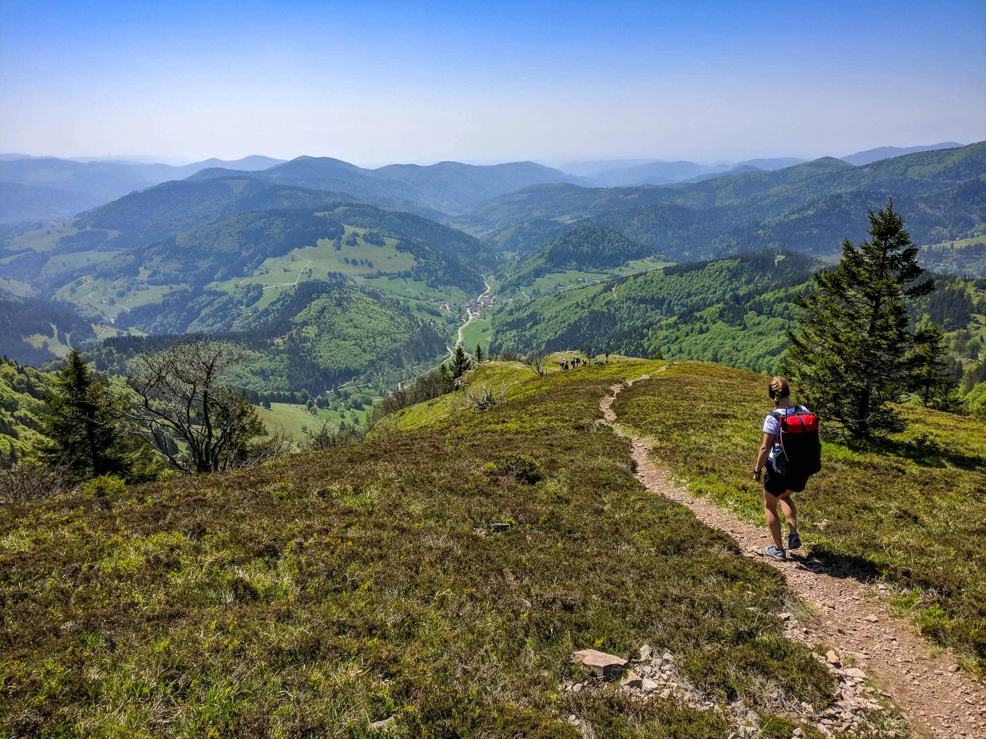
And if at some point you realise that a thousand vertical metres on the Schauinsland no longer feel like much: That is precisely when Freiburg's local mountains become your training ground. Anyone who regularly does the distance hikes here is ready for a Alpine crossing conditionality better prepared than he thinks. What is missing then is the equipment, you've had the fitness for ages. It stands in the Hiking equipment packing list.
Frequently Asked Questions
Take tram line 2 to Günterstal, then change to bus 21 for the base station of the Schauinsland cable car. From Bertoldsbrunnen, this takes around 20 minutes. From the base station, you can either go up by cable car or on foot in 2.5 to 3 hours.
From the valley station it is 6.7 kilometres and 817 vertical metres, which is 2.5 to 3 hours. Starting from the old town, it is significantly longer because the first ten kilometres are flat and the climb only comes at the end.
Yes, from the observation tower on the summit in clear weather. This works most reliably in winter during an inversion, when the Rhine Valley lies beneath fog and the air above it is dry.
Yes, and it is actually the better way. Light rail, Breisgau S-Bahn and Höllentalbahn serve almost all starting points, which means point-to-point hikes are possible instead of circular routes. The only important thing is to check the last return service of the day beforehand.
Not for the local hills, trail running shoes or mid-high walking boots are completely fine there. On the long descents from the Schauinsland and at the Feldberg, more tread and a stider shoe pay off in wet conditions and in winter.
Around 3.3 kilograms packed is a realistic figure, of which about 1.5 kilograms is water. Anyone stopping for refreshments along the way can manage with one litre and save half a kilo.
September and October are the most reliable: stable weather and clear views. The Kaiserstuhl is at its prettiest in March and April, and in the height of summer you are better off heading to the High Black Forest.
Sources
- Schauinslandbahn, technical data: 3,600 m route length, 746 metres altitude difference, Germany's longest circular cable car, in operation since 1930. schauinslandbahn.de
- City of Freiburg, Germany's tallest tree: „Waldtraut vom Mühlwald“ Douglas fir, planted in 1913, most recently 67.85 m (as of April 2024). freiburg.de
- Friedrichsturm tower on the Rosskopf (737 m): 34 m high observation tower of steel lattice construction, erected in 1889. alemannische-seiten.de
- City of Freiburg, climate in Freiburg: mean annual temperature in the city centre 11.4 °C, rising number of hot days. freiburg.de
- Kaiserstuhlpfad: about 22 km, around 700 metres of elevation gain, certified as a Quality Trail Wanderbares Deutschland. schwarzwald-tourism.info