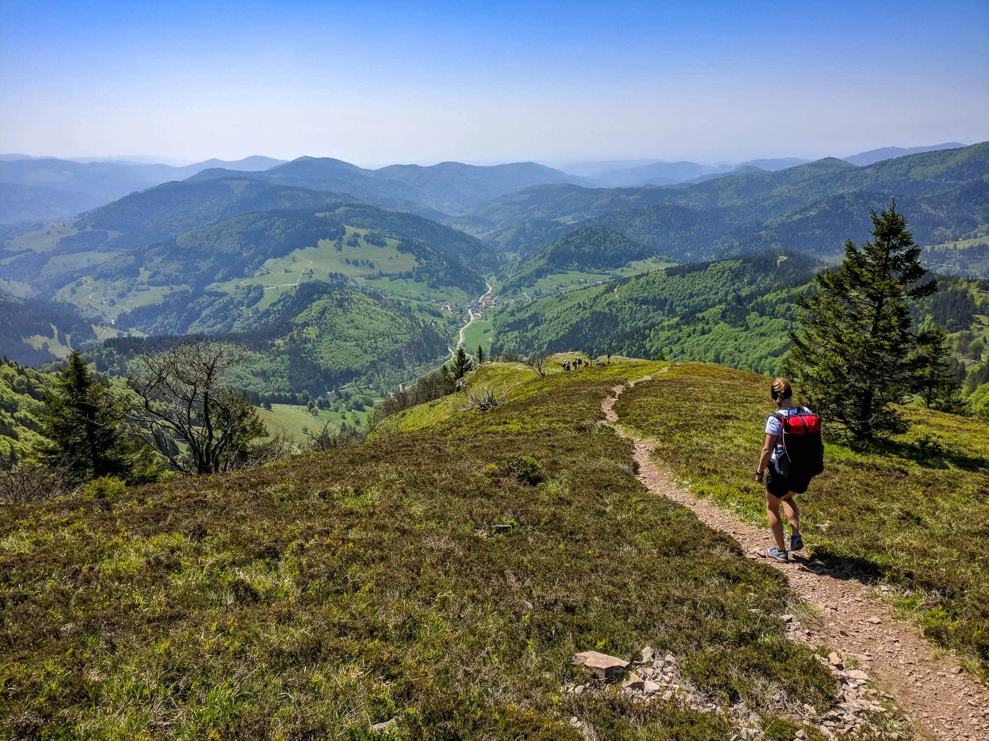
The Westweg is not the most spectacular long-distance hiking trail in Germany. It is the oldest and presumably the most obvious trail for learning what multi-day trekking actually feels like. 285 kilometres through the Black Forest, from Pforzheim on the northern edge to Basel on the Rhine. Marked since 1900 with a red diamond on a white background, maintained by the Black Forest Association, and walked every year by a few thousand people.
We build our rucksacks 30 kilometres as the crow flies from the Westweg corridor, in Emmendingen. When we test prototypes, we go out on the trail or one of its side branches. This makes this guide different from what you'd otherwise find for the Westweg: the trail from the perspective of a rucksack manufacturer who knows it as their local stomping ground.
We'll explain to you how many stages this is realistically possible in, when the Black Forest is truly accessible, where you can stay overnight, and above all: how to do the whole thing with under 5 kg on your back without missing anything. Low mountain range trails like this are the most obvious UL discipline in the DACH region, it's just that almost nobody knows it. Most people hike the Westweg with a 75-litre trekking backpack, which they bought for a planned Alpine crossing, and lug hardware through the Black Forest that the trail doesn't need. It can be done more elegantly.
What you will find in this guide: an honest itinerary with rounded distances and elevation gains, a seasonal assessment without tourism marketing, a complete UL packing list for the peak season, six concrete strategies specifically for low mountain ranges, and at the end an FAQ block with the questions we are most frequently asked by people interested in the Westweg. What you will not find: booking funnels, affiliate tables or yet another mention of KONUS cards without context.

Westweg by numbers: what you need to know about the profile
The Westweg connects Pforzheim with Basel and has been signposted as the first German long-distance hiking trail since 1900. The official route measures 285 kilometres[1], the elevation profile adds up to a good 8,000 metres of ascent, and nearly the same number come together on the descent.[4] That sounds like a lot, but it is spread over twelve stages, ...and not a single one of them resembles an Alpine pass. You'll hike through forests, across high moors, past mountain lakes, and over the highest peaks of Germany's low mountain ranges.
Route and elevation profile of the western variant, created from the GPS track. The three prominent humps in the profile: Hornisgrinde in the Northern Black Forest, then Feldberg and Belchen in the south. However, most of the elevation gain comes from the constant up and down in between.
The highest points of the Westweg are: Hornisgrinde (1.163 metres), Belchen (1.414 m), Feldberg (1.493 m, highest mountain in a German low mountain range). Sounds like little compared to the Alps, but after three days of Black Forest weather, it really feels like high altitude. Anyone who can handle the hardest stage (from Forbach to Unterstmatt, nearly 1,000 metres of ascent in one go) will manage the rest too.
From Titisee, the trail splits. Western Variant goes via Feldberg, Belchen and Blauen to Basel, that is the higher and more popular route. The Variations runs over Herzogenhorn and Dinkelberg, is scenically quieter and about five kilometres longer. If you're not actively weighing up the options, take the west variant. It has the views, the Belchen sunset and the more prominent high ground.
The Westweg is marked continuously with the Red diamond the Schwarzwaldverein, a brand you'll be automatically looking for after three days. On most stages, the signage alone is sufficient. Nevertheless: Komoot, Outdooractive or a GPX from the Schwarzwaldverein as a backup on your phone. The weather in the Black Forest changes faster than the markers can be found.
Westweg stages: from Pforzheim to Basel in 12 stages
The division into twelve stages is the most common, found in major guidebooks and also with the Schwarzwaldverein. Some opt for eleven stages (longer days), while others choose thirteen (more leisurely with a break). The following table represents a realistic average for someone who is a good walker but doesn't want to trek until sunset every day.
| Stage | Route | kilometres / hectometres | Overnight stay |
|---|---|---|---|
| 1 | Pforzheim → Dobel | ~24 km / ~700 m elevation gain | Guesthouse or hotel in Dobel |
| 2 | Dobel → Forbach | ~26 km / ~750 m ascent | Pension/Guesthouse Forbach (Murgtal) |
| 3 | Forbach → Unterstmatt | ~20 km / ~950 m accent | Berghotel Unterstmatt (Toughest Stage) |
| 4 | Alexanderschanze | ~22 km / ~600m of ascent | Schwarzwaldhochstraße, Hotel Zuflucht |
| 5 | Hark | ~25 km / ~550 m | Hark / Hausach-Vorland |
| 6 | House | ~15 km / ~350 m elevation gain | Hausach (Station, Resupply, Guesthouses) |
| 7 | Hausach → Wilhelmshöhe | ~24 km / ~800 m | Wilhelmshöhe / Schonach |
| 8 | Wilhelmshöhe → Hinterzarten | ~24 km / ~650 m ascent | Hinterzarten/Titisee (Resupply, Rail) |
| 9 | Hinterzarten → Feldberg Pass | ~14 km / ~700 M | Feldberg Hut or Bärental |
| 10 | Feldberg → Wiedener Eck (Belchen) | ~20 km / ~600 m elevation gain | Wiedener Eck or Belchenhaus |
| 11 | Belchen → Kandern | ~24 km / ~350m elevation gain | Kandern (small town, B&Bs) |
| 12 | Kandern to Basel | ~27 km / ~400 m | Basel SBB (Final destination) |
The stages are generally between 14 and 27 kilometres long, which is perfectly manageable given the low-mountain terrain and a sensible pace. Those who walk more slowly or take more breaks can split Stage 5 (from Alexanderschanze to Hark) into two halves or take a rest day in Hausach or Hinterzarten, both of which are towns with railway stations and amenities.
Distances and ascents in the table are rounded and based on the official stage plan of the Black Forest Association and the Black Forest Tourism Portal. Before the tour: current values via schwarzwaldverein.de or schwarzwald-tourism.info verify, both are continuously maintaining their stage pages.

Best season: when the Black Forest truly opens up
The Black Forest is a low mountain range that likes to behave like a small high mountain range. The higher elevations (Feldberg, Belchen, Hornisgrinde) often see snow between mid-November and mid-April, sometimes well into May. And the Black Forest isn't named that by chance: dense forests, high rainfall, foggy conditions. Plan realistically.
May to June: the best window
If you have a choice, take the Westweg in late spring. Mid-May to mid-June is usually snow-free at higher elevations, the days are long (a good 16 hours of daylight), the foliage is fresh green, and the mosquitoes are still scarce. Guesthouses and mountain huts are open but not yet fully booked. If you're flexible, this is honestly the best time of year for the Westweg.
July to August: warm, crowded, prone to thunderstorms
Peak season. Guesthouses full (advance booking essential), huts partly also. The weather is warm to hot, which can be pleasant in the Black Forest, but also brings thunderstorms. On the high ground of Feldberg and Belchen, they come quickly and fiercely. Plan breaks with a view of the weather forecast.
September to early October: the insider tip
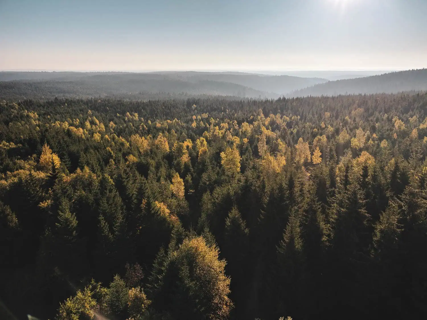
The golden autumn in the Black Forest is breathtaking, the beeches burn orange, the fir trees provide a contrast. Not much going on on the trail, guesthouses have more availability, the weather is often more stable than in summer. Disadvantage: shorter days (only 11 hours by late October), and the first nights of frost are possible. On a trekking tour, a sleeping bag or quilt with a comfort temperature of ≤ 5 °C is highly recommended.
Overnight stays: Cabins, Guesthouses, Trekking camps
The Westweg is considerably closer to civilisation than most Alpine trails. Almost every stage town has a guesthouse, inn or simple hotel. This is the standard form of accommodation: bed, shower, breakfast, and a hot meal in the evening. Prices per night range between €60 and €100 for a double room, often cheaper in a single dormitory. Booking ahead is recommended, especially in July/August.
Black Forest Club Huts and Shelters
The Black Forest Association operates a number of serviced and unserviced huts along the trail. Serviced huts have opening hours (often weekends or seasonal only), while the simple shelters are freely accessible but only offer protection from the weather, not full accommodation. Current list with opening hours: schwarzwaldverein.de.
Black Forest Trekking Camps
Since 2017, there have been official Trekking Campssimple, natural pitches in the forest, for a fee (€15 per camping pitch and night)[2], Online reservation. They aren't directly on the Westweg, but close to the trail; some can be integrated with minor detours. The camps have a composting toilet, a fire pit and otherwise: forest. This is the form of Black Forest accommodation that makes ultralight hikers happy.
Wild camping: legally grey, practically okay
Wild camping is generally not permitted in forests in Baden-Württemberg. However, bivouacking for one night without a campfire and leaving no trace is usually tolerated in practice, provided you avoid nature reserves and private land. Those who do this are taking In late, out early, no trace. There is no official permission for this, but an official announcement is also rare. Those who want to be on the safe side: trekking camps or a guesthouse.
Practically speaking, this means: if you want to do the Westweg strictly „wild“, mix trekking camps with guesthouses and occasional shelters. Camping the whole way without a guesthouse touch is possible, but not relaxing.
What the Westweg really wants from your rucksack
Here comes the manufacturer's section. Anyone who considers a low mountain range trail like the Westweg as a light version of an Alpine crossing will automatically pack too much. The demands are real, but they are different.
Metres climbed per day: moderate, but steady
500 to 950 metres of elevation gain per stage, spread over 14 to 27 kilometres. That is significantly less descending than on an Alpine crossing (typically 1,200 to 1,800 metres/day). This means your setup doesn't need to be optimised for heavy load transfer. A frameless rucksack is completely sufficient, because base weight plus daily provisions rarely exceed 7 kg.
Weather: Rain instead of storm
The Black Forest has rainy days. Many. At altitudes above 1,000 m, it can rain for six hours straight, even in midsummer. But storms in the high alpine sense (40+ km/h, combined with hail and open exposure) are rare. This means for your backpack: Water resistance is important. Taped seams and a waterproof material are worth their weight in gold here.
To be specific: on a typical Westweg hike, you’ll be packing your sleeping kit in and out at least three times in the pouring rain. If the inside of your rucksack gets wet because it’s only „water-repellent“, your sleeping kit will get wet, and if your sleeping kit gets wet, the hike is over. Packing liners and rain covers are workarounds that add 80 to 120 g of extra weight because the base material isn’t up to scratch. We’ve designed the Agilist so that these workarounds are unnecessary.
Volume: 50 to 55 litres is enough
If you’re travelling with ultra-light trekking kit (base weight under 5 kg), you don’t need a 70-litre rucksack. 50 to 55 litres is the right capacity for the Westweg, including consumables and a bit of extra space for an additional insulated jacket on chilly evenings at high altitudes. The Agilist 2026, with its 54-litre capacity, hits the sweet spot perfectly.
Trekking poles: recommended, but not essential
On an alpine crossing, poles are almost mandatory (knee insurance on long descents). On the Westweg, they are nice-to-have. The descents are shorter and less steep, you can manage without them. Anyone using trekking pole tents or pyramid tarps will take them for the hardware, otherwise they are optional.
Westweg Packing List: The Mid-Mountain Setup
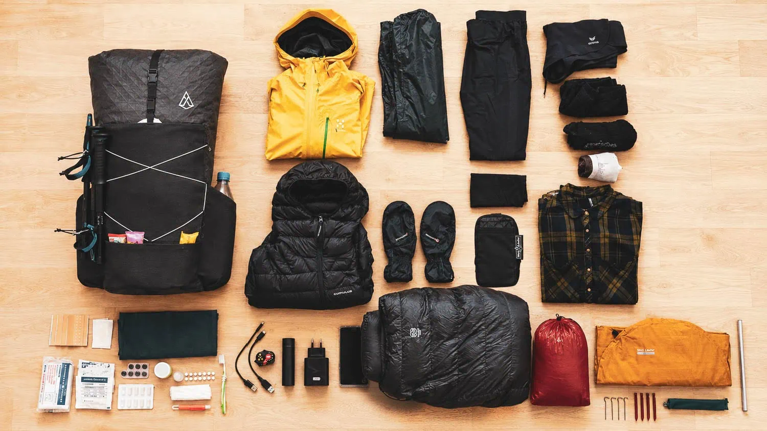
This packing list is a specific recommendation for the Westweg during the main season (May to September). All weights have been weighed, not taken from manufacturer specifications. You can find comparison values such as the full 3-season UL setup in our Lightweight packing list; Here is the Black Forest-specific variant.
| Item | Weight | Manufacturer's comment |
|---|---|---|
| WeitLäufer Agilist 2026 (54 L, size M) | 570g | Ultra 200X, most seams taped. On the Westweg, your best defence against the Black Forest’s constant rain. |
| Trekking pole tent or single-wall UL tent (e.g. Durston X-Mid 1) | ~750g | Closed shelter with floor. Tarp-only is too stressful in the Black Forest due to mosquitoes and unpredictable weather. |
| Pegs (6× Titan Shepherd's Hook) | 36 g | Especially since the Black Forest soils are mostly soft. |
| Down quilt 0 to 5 °C comfort temperature (e.g. Cumulus Quilt 300) | ~495 g | Highland nights will be in single digits in August too. A 10°C quilt won't be reliably sufficient. |
| Insulated mat with an R-value ≥ 4 (e.g. Therm-a-Rest NeoAir XLite NXT) | ~367g | An R-value of ≥ 4 is compulsory even in summer, because high-altitude soils quickly dissipate heat. |
| Rain jacket (e.g. OR Helium) | approx 180 g | In the rucksack, accessible every day. You'll put them on more often on the Westweg than on any Alpine trail. |
| Insulation jacket (down or synthetic, e.g. Cumulus Inverse) | ~230g | For evenings at high altitudes and Belchen sunsets. |
| Long-sleeved merino wool change shirt | 150g | Sleeping shirt and backup. Merino doesn't smell after three days, synthetics do. |
| Windproof Trousers (Ripstop Nylon) | ~50 g | Against wind and mosquitoes at high altitudes, only take rain trousers on autumn tours. |
| Replacement socks (Merino, 2 pairs) | Around 100g | Two pairs of socks, one on your body, one in the pack to dry. |
| Thin hat, thin gloves | ~95 g | High-coverage insurance. 95g to prevent cold, wet exhaustion in emergencies. |
| Kocher (Gas, BRS-3000T) + Pot 650 ml + Spoon + Lighter | Approx. 125 g | Gas is enough for 12 days without any problems; a 100g cartridge is sufficient with economical use. |
| Smartphone (Navigation, Camera, Emergency) + Power bank 10,000 mAh + Cable | Approximately 370 g | Power bank lasts for 3 to 4 days; recharge at guesthouses/huts. |
| Headlamp (e.g. Nitecore NU25 UL) | ~28g | Even in May, because hut trails in the Black Forest are often root-covered. |
| Water filter (e.g. Katadyn BeFree) + 1 L PET bottle | ~87 g | In the Black Forest there are many streams, but not all are drinkable (grazing animals). A filter is not optional. |
| Hygiene & First Aid (repacked, without packaging waste) | ~200 g | Blister plasters, tape, painkillers, antihistamines, sun cream (30 ml). That’s all you need. |
| Miscellaneous (seat pad, cord, map/back-up, bin bag) | Approximately 80g | The Sitpad provides additional support for the frameless rucksack – a dual benefit. |
That comes to a total of around 4.3 kg base weight. With water (1 L) and a day's supply of food (~500 g), you are looking at around 6 kg on your back. With two daily rations for stages without resupply (e.g. from Forbach to Unterstmatt), it's just under 7 kg. That is low-range ultralight hiking: a setup that you can still carry without pain after twelve days.
Was conscious not On the list: a second pair of shoes, a thick travel towel, a second pair of trousers, a standard first-aid kit in a plastic box, a 20-litre dry bag, a multi-tool, a brass compass. None of this is essential on the Westweg. What’s deliberately on it is: an insulated jacket (even in summer), a water filter (even though the guesthouses have water every 20 km), and spare socks (two pairs, because one pair is almost always damp). These three things are the most frequent items to be cut by „money-saving tips“ on the internet, and all three of them are a reflex of saving in the wrong place.
6 UL strategies specifically for low mountain ranges
Most UL tips online are written for Alpine crossings or thru-hikes. On a low mountain range trail like the Westweg, different levers apply. Here are the six strategies we recommend for your Westweg setup.
No frame, lighter weight.
For base weights of less than 5 kg and total daily weights of around 7 kg, a frameless rucksack more comfortable than any aluminium frame. You save 600 to 1,500 g just by your choice of rucksack. On the Westweg you'll notice that by stage three at the latest, when your shoulders are free and not battered.
Use the dense network of huts for resupply.
Unlike on a thru-hike, you never have to carry more than two days’ worth of food on the Westweg. Hausach, Hinterzarten, Titisee and several guesthouses along the route have supermarkets or bakeries. Make a point of planning short supply loops – this will save you 1 to 2 kg in your rucksack over the course of the entire tour.
Trekking poles are optional; there is no compulsory weight requirement.
On the Westweg, poles are a comfort extra. Anyone not using a trekking pole tent can leave them behind and save 280 g. Anyone who needs them (knee insurance, tent hardware) takes them and actually uses them instead of strapping them to their rucksack.
Do not hoard water.
The Black Forest has a spring, a stream or a fountain every one to two hours. More than 1 litre of water in your rucksack is a wasted load on most stages. Take a filter, top up shortly before the ascent, and drink it empty again at the top. That makes a 1 kg difference compared to „dragging 4 litres along, just in case“.
A quilt is better than a sleeping bag, even in low mountain ranges.
The reflex „low mountain ranges are warm, summer sleeping bag is enough“ goes wrong in high locations. Instead: a quilt with a comfort temperature of 0 to 5 °C, combined with a good insulating mat (R-value ≥ 4). You save 150 to 250 g compared to a mummy sleeping bag and sleep warmly in all weather.
Make a conscious effort to set aside a day for your pension.
One real guesthouse overnight stay per five days is no ultralight betrayal. It saves you quilt residual heat, it dries your wet setup, it gives you a shower. Plan it strategically after the hardest stages, i.e. after stage 3 (Forbach to Unterstmatt) and stage 9 (Hinterzarten to the Feldberg Pass).
Which rucksack is best for the Westweg?
Anyone who’s already into ultralight hiking knows the answer. Anyone considering a multi-day trail in the Black Forest for the first time will usually be hearing this for the first time: for the Westweg, a frameless rucksack with a capacity of between 50 and 60 litres is almost always a better choice than the classic trekking rucksack with a capacity of 65 to 75 litres.
Our suggestion – honest and straightforward: the Agilist 2026. Weighs 570 g, 54-litre capacity, most seams fully taped; the Ultra 200X itself is 100 % waterproof and PFAS-free. Developed in the Black Forest, around 30 kilometres as the crow flies from the Westweg corridor. The fabric comes from the sailing industry (Challenge Sailcloth) and is designed to withstand salt water and UV rays, which, ironically, works perfectly with the Black Forest’s constant rain.
If you blow out a seam on the trail, a 30 km drive to Emmendingen is all it takes. We have the lab on site, we repair. Shipping of the backpacks themselves comes directly from DE, manufactured in a specialised high-tech production facility in Vietnam, a 500-piece batch in a solar-powered, BSCI-certified factory. We pass the cost savings directly on to you (€299 instead of previously €319).
Journey to Pforzheim, return journey from Basel
Both are incredibly easy to do by train. Pforzheim Central Station lies on the ICE/IC corridor between Stuttgart and Karlsruhe and can be reached from almost every major German conurbation in under six hours. From the station to the Westweg starting point at the market square: 15 minutes on foot. Anyone coming from southern Germany can even be there in under three hours. A tour with rail travel there and back saves you the car logistics nightmare (parking the car in Pforzheim, taking the train back from Basel to Pforzheim at the end, picking up the car, and only then heading home) that most guidebooks politely ignore.
The final destination is Basel. Specifically: Basel SBB or Basel Badischer Bahnhof, both with an ICE connection back to Germany. On the final leg of the journey, you end up first in Switzerland and then back on the German side, depending on the route. Taking your passport is a good idea, even though border controls are usually just a formality. If you want to wind down the day in a relaxed way: a beer by the Rhine in Basel, then back on the night train—that is a well-deserved reward after twelve days.
Anyone staying overnight in the Black Forest automatically receives the in most guesthouses KONUS guest cardfree use of buses and trains throughout the Black Forest holiday region[3]. Handy if you want to cut a stage short or take a rest day with a public transport trip. Also a good plan B if the weather makes a stage completely unviable: train to Hinterzarten, take a breather for the day, and get back on the trail the next morning.
Frequently asked questions about the Westweg
The Westweg can traditionally be hiked in 11 to 13 days. The most common breakdown is 12 stages, covering 14 to 27 km per day. Those who hike faster can complete it in 10 days, while those who want more breaks can plan for 14. Two weeks of holiday is also plenty of time.
Mid-May to mid-June and mid-September to early October. May/June has the longest days and fresh greenery, early autumn brings more stable weather and fewer crowds. High summer (July/August) is prone to thunderstorms and busy in the guesthouses.
Wild camping in the forest is not permitted in Baden-Württemberg, but a one-night bivouac is usually tolerated in practice if no trace is left behind. You can officially pitch your tent at the Black Forest Trekking Camps (15 € per pitch and night, book online) or at campsites along the route.
With a base weight under 5 kg, it fits frameless UL backpack perfect with a volume of 50 to 55 litres. The WeitLäufer Agilist 2026 with a capacity of 54 litres and a net weight of 570 g, it has been designed precisely for this use case. Anyone travelling with a traditional setup and a base weight of over 8 kg needs a rucksack with an aluminium frame or at least carbon stays.
With a red rhombus on a white background, the official trail logo of the Schwarzwaldverein since 1900. The markings are continuous and can be found on most stages without a map or GPS. Nevertheless, GPX from the Schwarzwaldverein as a backup on the phone, because in fog and storms markings can be easily overlooked.
Moderate. 285 km with a total of well over 8,000 metres of ascent, spread across twelve stages. No technically demanding sections, no via ferratas, but twelve days in a row with luggage requires trail fitness. Anyone who regularly does day tours with ascents and has completed a 5-day hike once can manage the Westweg.
Pforzheim Hauptbahnhof is located on the ICE/IC corridor and is reachable from any major German city within under six hours. The endpoint is Basel SBB or Basel Badischer Bahnhof, both with ICE connections back to Germany. Take your passport for the Swiss border.
At Titisee, the trail splits. The western variant goes over Feldberg, Belchen and Blauen; it is higher, more scenic and more popular. The eastern variant over Herzogenhorn and Dinkelberg is quieter in terms of scenery and about 5 km longer. If you don't actively weigh up the options, take the western variant. It has the high altitudes that define the Westweg character.
Next step: assemble your setup
285 kilometres of the Black Forest, easily accessible and seamlessly waymarked: the most obvious trail in Germany for learning what UL trekking really feels like.
If you're still looking for the right solution for the rucksack: the Agilist is our proposal for anyone wanting to start with a base weight of under 5 kg, without compromising on weather protection and comfort. 570 g, most seams taped, waterproof Ultra 200X, developed in the Black Forest.
If you want to delve deeper: our Lightweight packing list shows the full 3-season setup, the Ultralight Trekking Guide explains the basics, and under Hiking gear you will find the category overview. Anyone planning the step from low mountain range to high mountains should proceed to Alpine crossing.
Sources
- Westweg portal of Schwarzwald Tourismus GmbH with route length, stages and waymarking. schwarzwald-tourism.info
- Frequently asked questions about the official Black Forest trekking camps, including the price per pitch and night. trekking-blackforest.co.uk
- Official information page on the KONUS guest card: free travel on buses and trains in the Black Forest holiday region. schwarzwald-tourism.info
- GPS track of the Westweg western variant with route length and elevation gain (well over 8,000 m of ascent and descent). outdooractive.com