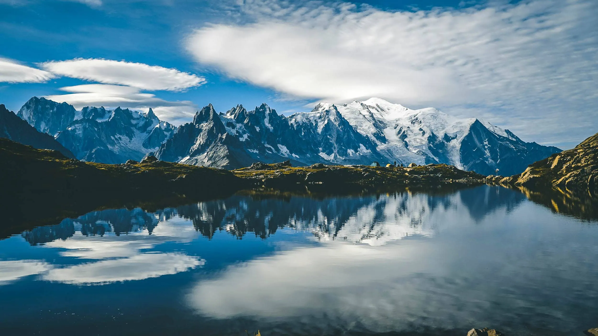
The Tour du Mont Blanc is the benchmark by which all other treks in the Alps are measured: around 170 kilometres in a grand arc around the Mont Blanc massif, through France, Italy and Switzerland, with approximately 10,000 metres of ascent and the same again in descent. You'll circumnavigate the highest mountain in the Alps completely and see it from every conceivable perspective: from the gentle French alpine pastures to the rugged Italian southern side and on to the Swiss glacier valleys.
The good news for everyone who likes to travel light: you have a choice. Either you go from refuge to refuge, in which case the huts provide bed and board and your backpack stays small. Or you take a tent and sleeping system with you and become independent. Both options work, and both make very different demands on your luggage. That's precisely what this guide is about, in addition to the bare stage data.
You’ll receive all stages with verified key data, the booking logic of the refuges (the point where most planning fails), an honest assessment of the difficulty, and two packing list scenarios that will get you easily over the passes.
The Tour du Mont Blanc at a glance
The most important key facts before we get to the stages:
| Key data | Value |
|---|---|
| Distance (Standard lap) | 170 km |
| Metres of ascent | ~10,000 m |
| Metres of descent | ~10,000 m (Circular route) |
| Stages (classic) | 11 |
| Duration depends on the pace | 7 to 11 days |
| Countries | France, Italy, Switzerland |
| Highest point (standard route) | Grand Col Ferret, 2,537 m |
| Start/End | Les Houches (or Chamonix) |
| Season | Mid-June to ~20 September |
The trail is a circular route, so you start and end at the same place, classically in Les Houches in the Chamonix Valley. Because it is a loop, there is no „summit“ in the true sense of the word: the highest point reached on the standard route is the Grand Col Ferret at 2,537 metres, a pass between Italy and Switzerland. You do not climb Mont Blanc itself (4,806 m), you hike around it. That is precisely what makes the tour so accessible: it is demanding, but it does not require mountaineering equipment or glacier travel.
The stages of the Tour du Mont Blanc
The classic version divides the tour into 11 stages, counter-clockwise from Les Houches. The distance and metres climbed per day vary considerably depending on the chosen variant and overnight location, which is why, instead of precise individual values, the walking time plus the defining characteristic of each stage is given here:
| Stage | Walking time | Character / Key Passage |
|---|---|---|
| 1. Les Houches → Les Contamines | About 5.5 hours | Gentle start over the Col de Voza, good for warming up. |
| 2. Les Contamines → Refuge de la Croix du Bonhomme | 5 to 6 hours | First long climb over Col du Bonhomme (2,329 m) and Col de la Croix du Bonhomme (2,479 m). |
| 3. Croix du Bonhomme to Elisabetta Refuge | 5 to 6 hours | Over the Col de la Seigne (2,516 m) into Italy, first major south flank of the massif. |
| 4. Rifugio Elisabetta → Courmayeur | 6 to 7 a.m. | A balcony path with views of the Italian glaciers, followed by a long descent to Courmayeur. |
| 5. Courmayeur → Bonatti Refuge / Val Ferret | 7 to 8 hours | Long stage, the most beautiful view of the Grandes Jorasses. |
| 6. Rifugio Bonatti to La Fouly | Around 6 hours | Over the Grand Col Ferret (2,537 m), highest point, border into Switzerland. |
| 7. La Fouly → Champex | About 4 hours | A quiet day in the valley through Val Ferret, a good opportunity for a short stage. |
| 8. Champex → Trient | 7 to 9 hours | Choice: the challenging Fenêtre d’Arpette (~2,665 m) or the easier Bovine route. |
| 9. Trient → Tré-le-Champ | ~5 hours | Back into France over the Col de Balme (2,191 m), with Mont Blanc in view again. |
| 10. Tré-le-Champ → La Flégère | ~5 hours | Ladders and rope-secured sections towards Lac Blanc, the most beautiful balcony of the tour. |
| 11. La Flégère → Les Houches | 5 to 6 hours | High-level path above Le Brévent, final descent into the valley. |
Which direction, and why anti-clockwise?
The vast majority go round counter-clockwise, so from Les Houches towards Les Contamines. There's a practical reason for this: you mostly walk with the sun at your back rather than in your face, the climbs are distributed more favourably, and you encounter less oncoming traffic from trail runners and stage groups. Going clockwise is just as doable, you'll just be on your own more often and have to re-distribute a few metres of altitude.
Options: Fenêtre d’Arpette or Bovine
The most famous decision on the tour has to be made between Champex and Trient. The Fenêtre d'Arpette leads to around 2,665 metres, which is the highest point you can reach on the entire circuit, with a direct view of the Trient Glacier. The price: a steep, partly boulder-strewn ascent and descent that becomes serious in wet weather or with lingering snow. The Bovine route is the weather-safe and physically kinder alternative via alpine pastures. Both end in Trient. Those who are fit and catch good weather take the Fenêtre; everyone else will be well off with Bovine.
The key points
Technically the tour is a mountain hiking trail, not a via ferrata. The only places where you'll really need your hands are the ladders and secured sections above Tré-le-Champ on the way to Lac Blanc (Stage 10). They are well secured, but exposed, so anyone struggling with a fear of heights should be aware of this. If the ladders are too much for you, take the lower bypass. Otherwise: solid footing is sufficient, you won't need any glacier equipment anywhere.

Refuge or tent? The decision that changes everything
Unlike a pure hut-to-hut tour, you have real choice on this route, and it determines more than anything else how heavy your rucksack will be. Both variants have their justification.
The Refuge variant is the classic. Along the route, there are mountain huts and gîtes at convenient intervals, almost all with half-board. This means you don't need to carry a tent, sleeping bag (a lightweight sleeping bag liner is sufficient), or a stove. Your base weight will therefore remain below that of a standard hut tour, you'll be warm and well-fed in the evenings, and you'll save every gram of sleeping system. The catch: You are tied to your reservations and thus inflexible, more on that later.
The Tent variant makes you independent. You'll be staying overnight at campsites and designated bivouac areas along the route and deciding spontaneously how far you want to go. The price is weight and volume: shelter, sleeping bag, sleeping mat and stove are added, quickly making it 2 to 3 kilos more. Wild camping around Mont Blanc is not a lawless area, by the way: rules differ by country and are sometimes strict (most restrictive in Switzerland). Stick to official spots and bivouac areas, and you'll be on the safe side.
Book refuges: early or not at all
If you take one sentence away from this guide, it's this one: Whether your tour takes place is settled during the refuge reservation. The huts along the route are among the most sought-after in the Alps, and they are small. Many refuges open bookings for the upcoming summer season as early as late autumn of the previous year, and the most popular ones are then booked up within days, sometimes hours.
In practice, this means: if you want to go in July or August, you ideally plan in the autumn before. You first decide on your stages and therefore your overnight stops, and then book the entire chain. A single hut that you can't get can disrupt your entire stage plan because the distances between the refuges are not arbitrary.
Regarding the budget: an overnight stay with half-board in a dormitory costs roughly €60 to €80 depending on the hut and country, and more in more comfortable gîtes. Over seven to ten nights, plus drinks, lunch breaks, and transfers, the tour quickly adds up. The camping option is considerably cheaper, but it costs you weight. In Switzerland, you will also need Swiss francs, as not everywhere takes cards.
How hard is the Tour du Mont Blanc really?
The honest answer: technically moderate, physically demanding. On most stages you are on well-marked mountain hiking trails without any notable scrambling, with the ladder section at Tré-le-Champ and the optional Fenêtre d'Arpette as the only real crux sections. Surefootedness is enough; you don't need a via ferrata set or crampons.
The challenge lies elsewhere: in the total. Around 10,000 vertical metres of ascent over seven to eleven days means 700 to over 1,000 vertical metres up every single day and just as many back down, often with long walking times of six to eight hours. What is needed is endurance, day in, day out. Anyone who regularly goes out into the mountains with a daypack can manage this, provided the rucksack on the multi-day trail stays light.
And this is precisely where weight becomes a real factor. Over 10,000 metres of elevation gain, every kilo saves you measurable energy that you will still need on the eighth day. On this tour, a lightweight rucksack is the simplest adjustment that allows even average-fitness hikers to enjoy the route rather than just endure it.
The best time for the Tour du Mont Blanc
The season is clearly defined: most refuges open in mid-June and close around 20 September.
Within this window, July and August are the most reliably snow-free and warm, but also the busiest, and it gets crowded along the route especially during the UTMB trail-running event at the end of August. In early July, old snow may still lie on the north sides of the high passes. Early to mid-September is the sweet spot for many: more stable weather conditions, clearer views, fewer crowds, but shorter days and the first huts closing. Whenever you go, at this altitude afternoon thunderstorms and a sudden change in the weather are possible at any time, even in high summer. Start early, be across the exposed passes by midday, and have your Rain jacket always close to hand.

Packing list: light for Mont Blanc
Now to the luggage, our home game as a manufacturer. Because the tour has two accommodation modes, there isn't just one packing list. The basis is identical, however, and it is surprisingly streamlined. Worn clothing, shoes and poles don't count, you have those on your body.
| Item | Weight | Manufacturer's comment |
|---|---|---|
| WeitLäufer Agilist (2026, size M) | 570g | Main compartment taped: you can forget about the pack liner. |
| 3-layer laminate rain jacket | approx 180 g | At the passes, it's mandatory; weather changes quickly. |
| Lightweight rain trousers | ~120g | More valuable than on a mountain hut tour for long exposed crossings. |
| Insulation jacket (down or synthetic) | ~250g | For the cold mornings on the cols and the evenings at 2,500 m. |
| Spare shirt (Merino) + 2 pairs of socks | ~240g | For eleven days, functional underwear is more important than quantity. |
| Beanie + thin gloves + Buff | ~110 g | At 2,500 m, it can be close to zero degrees even in August. |
| Sun protection (sunglasses, SPF 50 sun cream, lip balm) | ~120g | Three countries, plenty of open high mountains, plenty of UV. |
| First aid + blister plasters + hygiene/cosmetics | ~250g | Don't skimp on the blister plaster, radically reduce everything else. |
| Headlamp | ~28g | For early starts before long stages. |
| Powerbank 10,000 mAh + Cable | ~195 g | Electrical sockets are in short supply at Refuge and highly sought-after. |
| Water filter + 2 x 1-litre bottles | ~115 g | There are plenty of springs and wells; you hardly need bottled water from the hut. |
| Snacks/emergency rations per day | ~400 g | There are no places to stop for refreshments for quite a long way between the villages in the valley. |
| Documents (Passport, card/app, cash in € and CHF) | 150g | Three countries, three possible payment scenarios. |
Up to this point, you're carrying around 3.2 kilos on your back, including water and your daily snack. What else gets added depends entirely on where you're sleeping.
The Refuge version: what you really need
If you’re staying in a hut or a gîte every night, your packing list is almost complete. The only thing missing is a lightweight mountain hut sleeping bag made of silk (~110 g; compulsory at many refuges anyway) and a Small microfibre towel. That's all. No tent, no thick sleeping bag, no stove, because half-board means a hot evening meal and breakfast are included. This keeps your total weight well under 4 kilos and means you'll be carrying hardly any more over eleven days than you would on a day walk.
The tent version: the sleeping system on top
If you want to be independent of reservations, the complete sleeping and cooking system comes into play. This is where all the extra weight sits, and it is precisely here that it is decided whether „with a tent“ becomes six or ten kilos. With consistently lightweight gear, the addition remains manageable:
| Item | Weight | Manufacturer's comment |
|---|---|---|
| UL tent (1 person, trekking pole construction) | ~900 g | Use your walking poles instead of separate tent poles – this saves on weight and reduces the pack size. |
| Sleeping bag or quilt (down, comfort temperature around 0 °C) | ~650 g | At 2,000 metres, even summer nights can get chilly, so it’s worth packing a few extra layers. |
| Sleeping mat (inflatable, R-value ~4) | ~420g | Mind the R-value, thickness alone tells you little about the insulation. |
| Cooking kit (gas stove, pot, cartridge, spork) | ~430 g | It’s enough to boil water – that’s all you need when you’re out and about. |
| Additional meals for self-catering days | ~400 g | If you don’t have half-board, you’ll have to pay for breakfast and dinner yourself. |
At the end of the day, the two paths stand in opposition to each other like this:
| Post office | Weight |
|---|---|
| Core setup including rucksack, water, day snack | 3.2 kg |
| Refuge Accessory (Sleeping bag liner + towel) | 0.2 kg |
| Shelter-Variant Total | ~3.4 kg |
With a tent you therefore end up at around 6 kilos on your back, with a refuge under 3.5. Both are a long way from the 12 to 15 kilos that many start the tour with. With around 10,000 metres of elevation gain, this difference pays off on every single climb.
| Post office | Weight |
|---|---|
| Core setup including rucksack, water, day snack | 3.2 kg |
| Sleeping system (tent, sleeping bag, sleeping mat, cooking system, provisions) | ~2.8 kg |
| TENT VARIANT TOTAL | ~6.0 kg |
What's particularly important when packing for this round
Three things distinguish the Tour du Mont Blanc from a normal Alpine tour, and all three have consequences for your packing list. Firstly, the range of weather in a single day: you start cool in the valley in the morning, sweat at midday on the sunny Italian south side and are standing in the wind an hour later on a 2,500-metre pass. Therefore, rely on a consistent shift system from thin layers rather than individual thick parts, you react in minutes instead of repacking in the valley. This is precisely what the rain jacket, rain trousers, insulation jacket, and merino shirt in the core system are coordinated for.
Secondly, the length: Every item you only „might“ need, you carry for 170 kilometres and 10,000 metres of elevation gain for nothing. The most honest question when packing: „Would I miss it if it were gone?“ Third spare shirt, second pair of trousers, the bulky wash bag: those stay at home. Thirdly, the water: springs, wells and refuges along the route provide plenty of refills, two litres capacity plus filter are sufficient. Carrying three or four litres in one go is wasted weight around here.
One last, banal, but effective tip: Weigh your complete setup once at home on a kitchen scale and enter it into a weight app like Lighterpack One, ideally in two lists for the refuge and tent versions. Only when you see in black and white that your „light“ towel weighs 180 g can you make an informed decision about what actually comes with you. That is the quickest way from feeling light to demonstrably light.
Arrival and Three-Country Logistics
The classic route is via Geneva. From Geneva airport or train station, shuttle buses and shared transfers will take you directly to Les Houches or Chamonix in around one to one and a half hours. You can also travel by train via Geneva and the Mont-Blanc Express cog railway into the Chamonix valley. You won't need a car for the tour, and it would actually be more of a hindrance, as you'll end up back at the start anyway on this circular hike.
On your travels, you'll cross a national border three times without checks, but with practical consequences: in Switzerland, you'll pay in Swiss francs, and your mobile network will change, which can be costly with roaming tariffs. Pack your ID card, download the offline maps for all three countries beforehand, and have some cash in both currencies with you.
Frequently asked questions about the Tour du Mont Blanc
The standard circuit is around 170 kilometres long and covers approximately 10,000 metres of ascent and the same amount of descent, as it is a circular route. Condensed guided variants with transfers shorten this to around 130 kilometres.
The classic route comprises 11 stages. Depending on your pace and chosen variations, most people complete the circuit in 7 to 11 days. Trail runners can tackle it in a few days, while those who have time and want to visit summits should plan for longer.
Technically, the tour is a mountain walking trail with no glaciers and no via ferrata, only the ladders at Tré-le-Champ and the optional Fenêtre d’Arpette being exposed. In terms of fitness, it is demanding: around 10,000 metres of ascent over seven to eleven days requires good stamina.
The refuges usually open in mid-June and close around 20 September. July and August are the most reliably snow-free but also the busiest. Early to mid-September often offers more stable weather and fewer crowds, but with shorter days.
Yes, absolutely and very early. Many huts open bookings for the summer season as early as late autumn of the previous year and are fully booked within days. Many refuges can be booked centrally via autourdumontblanc.com To book.
Both are possible. The refuge option keeps your backpack light (no sleeping system) and is more comfortable, but ties you to reservations. The tent option makes you independent and is cheaper, but costs an extra 2 to 3 kilos of luggage. Wild camping regulations vary by country; stick to official sites and bivouac zones.
For the refuge variant, 30 to 40 litres are more than enough, as a tent and sleeping bag are not required. For the tent variant with a complete sleeping system, you should plan for 45 to 55 litres. More important than the volume is the weight: with a strict packing list, you'll stay under 3.5 kilos as a refuge hiker and around 6 kilos with a tent.
Next step: plan your turn
You now have everything you need for the planning: the stages, the refuge logic, the seasonal window and two packing list scenarios. The most important next step leads to the calendar: set your timeframe, decide on a refuge or tent, and secure your overnight stays as early as possible if you are staying in a hut. The rest is anticipation.
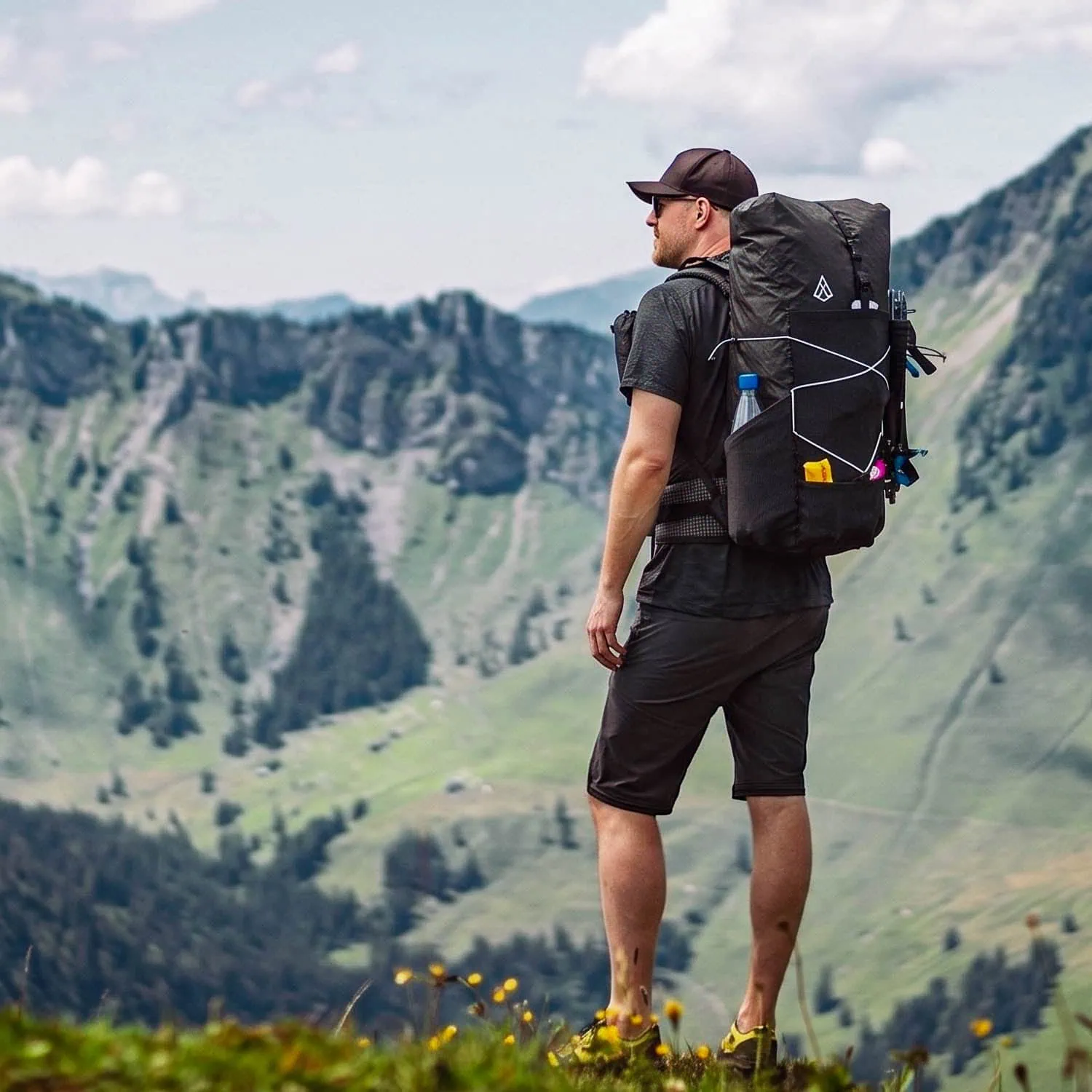
And if your current backpack is simply too heavy for a trip like that: take a look at the Agilist Come on, we developed it for precisely this kind of tour. 570 g, the main compartment completely taped, rolled up small to the compact Refuge format and fully unpacked, enough volume for the complete tent setup. A backpack for both routes around Mont Blanc.