
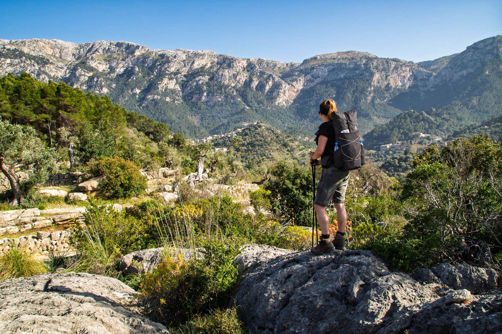
The GR221 is the long-distance hiking trail for which Mallorca is known in walking circles: 150 kilometres through the Serra de Tramuntana, from Port d’Andratx in the south-west to Port de Pollença in the north-east, along paths that charcoal burners, snow collectors and olive farmers built over centuries using dry-stone walling techniques. Hence the name Ruta de Pedra en Sec, the Dry Stone Route. You walk along 18th-century cobbled stone steps, past limestone gorges, through holm oak forests, and almost every day you catch sight of the sea at some point.
I walked the GR221 in April 2015, around 100 kilometres from Port d’Andratx to the Cúber reservoir, back then with a tent. A lot has changed since then: the trail is marked all the way through, the Consell de Mallorca's refuge network has grown, and the legal situation regarding camping is clearer than I read it back then. One thing has remained: water is the issue that dictates your tour here. That is precisely what this guide is about, alongside stages, refuges, the season and a packing list that won't weigh you down in the limestone terrain. Where the GR 221 stands in comparison to other European trails is shown by our Overview of Europe's long-distance hiking trails.
The GR221 at a glance
The Serra de Tramuntana has been a UNESCO World Heritage Site since 2011, inscribed as a cultural landscape[5]Terraces, irrigation channels, charcoal burner sites and snow houses, all built from dry-stone limestone without mortar. The GR221 threads precisely these structures together. The Consell de Mallorca, the island government, has been developing the path piece by piece since the 1990s, runs the refuges and marks the route in red and white. It is not finished: large parts of the Tramuntana are private property, and the Consell explicitly points out that individual sections are still „in planning and not signposted“.[1]. Even so, the path has been fully accessible since 2023.
| key figure | Value | Comment |
|---|---|---|
| Length of main route | 150.1 km | Port d'Andratx to Port de Pollença, plus 111 km of signposted variants[1] |
| Stages | 9 | Official classification by the Consell. Most walkers take 8 to 10 days. |
| Highest point | ~1,200 m | Coll des Prat near the Cases de sa Neu, the old snow houses, between Tossals Verds and Lluc |
| Metres gained | ~6,000 hm | Ascending and descending, individual stages with up to 1,000 vertical metres |
| Difficulty | T1 to T3 | Mountain walking trail in limestone, occasional chains, sure-footedness required |
| Overnight stay | Refuges | Consell-Refugis €14 per night, plus hostels and hotels in the villages |
| Best time | Spring, autumn | March to May and October to November. Summer too hot and too dry. |
| Water | 3 L per day | Hardly any reliable sources, replenishment only in the villages |
The 9 stages of the GR221
The Consell divides the GR221 into nine stages, from refuge to refuge or from village to village in each case. The distances in kilometres below are rounded to the nearest whole number because the details vary by one to two kilometres depending on the track. The walking times are for a normal pace with breaks, excluding swimming in Cala Deià.
Route and elevation profile of the GR221, created from the OpenStreetMap track. The nine stages follow the layout of the Consell de Mallorca, diamonds mark the refuges, dashed lines show the Galatzó variant. The profile shows why stages 6 and 7 are the tough ones: the climb from Sóller to the Cúber reservoir and the Coll des Prat as the highest point. Map background © MapTiler © OpenStreetMap contributors. Tap the map to enlarge.
| Stage | Length | Comment |
|---|---|---|
| Port d’Andratx to Sant Elm | ~9 km | 3 to 4 hours, ~600 m ascent. Warm-up stage via the Coll de sa Gramola. Those landing late can stay overnight in Port d'Andratx and start in the morning. |
| From Sant Elm to Estellencs | ~24 km | 7 to 8 hours, ~1,000 vertical metres. Via the La Trapa monastery ruins and the Moleta de s’Esclop. Longest and driest stage, no water along the way. Refugi Ses Fontanelles (private) at the halfway point. |
| 3 Estellencs to Esporles | ~14 km | 4 to 5 hours, ~350 m elevation gain. Easiest stage, across the terraces of Banyalbufar and through holm oak forest. |
| 4 Esporles to Can Boi (Deià) | ~23 km | 7 to 8 hours, ~1,200 vertical metres. Via Valldemossa and the Camí de s’Arxiduc, the most scenic stage. Many split it in Valldemossa. |
| C'an Boi to Muleta (Port de Sóller) | ~10 km | 3 to 4 hours, ~250 m ascent. Coastal stage with the option of swimming in Cala Deià. The Refugi Muleta is located at the lighthouse above the harbour. |
| 6 Muleta to Tossals Verds | ~26 km | 8 to 9 hours, ~900 m elevation gain. Through Sóller and Biniaraix, then up the paved Barranc de Biniaraix to the Coll de l’Ofre and past the Cúber reservoir. From Sóller it is still about 19 km. |
| 7 Tossals Verds to Son Amer (Lluc) | ~16 km | 6 to 7 hours, ~800 m elevation gain. Via the Coll del Prat, the highest point of the route. Pure karst terrain, difficult orientation in mist. |
| 8 Son Amer bis Pont Romà (Pollença) | ~17 km | 5 to 6 hours, ~250 m ascent, ~700 m descent. From the Lluc monastery down towards the plain. |
| 9 Pont Romà to Port de Pollença | ~7 km | 2 hours. Flat finale right down to the sea. |
Start in Port d’Andratx or Es Capdellà?
The official route begins at the port of Port d'Andratx. The Galatzó variant starts in Es Capdellà and leads via the public estate of Finca Galatzó, with the refuge of the same name, to Estellencs. It saves you the dry second stage and is the more relaxed choice for the start. If you want the complete coastal arc, start in Port d'Andratx and take the water issue on stage 2 seriously. I would start there again today. The first two days were the loneliest of the whole tour.
The key points
The descent below La Trapa on stage 2 has a short limestone section secured with chains. Exposed, but easy to walk if you keep to the right. The Barranc de Biniaraix on stage 6 is a cobbled stepped path with dozens of switchbacks, a real effort going uphill in the midday sun. The Coll des Prat on stage 7 is a karst landscape without shade, where cairns are the only trail markers. In fog, you need the track there. Then there are the many little things: gates in private fences that you close behind you, and sections of the path that detour in a wide arc around fincas.

Water: the scarcest resource in the Tramuntana
On stage 2, I had three litres with me, for 24 kilometres and 1,000 metres of elevation gain. In the shade it was 25 degrees, in the sun over 30, in mid-April. On the map, a fountain was marked past Sant Elm near the old Refugi, and I had based my planning on it. The fountain was dry. The last few kilometres to Estellencs I walked with a single sip left in my bladder and bought nine litres of water and two colas at the first café.
Since then, I plan differently in the Tramuntana. There are no reliable natural springs on the GR221. The cisterns at the old fincas are mostly dry by early summer, and what is marked on maps as a font may or may not be flowing in April. The villages are reliable. You pass through a place with a supermarket or café almost every day: Estellencs, Esporles, Valldemossa, Deià, Sóller, Pollença. In between, you carry everything yourself.
My rule: three litres per person on the morning of a long leg, two on the short ones, top up at the refuge in the evening. In heat over 25 degrees, more like four. That sounds a lot, but in the sun above the sea you sweat more than you realise. How to plan your fluid intake in the heat and schedule your day around the midday sun is explained in detail in the Guide to hiking in the heat.
Booking refuges: how the Consell system works
The Consell de Mallorca runs a network of basic mountain huts, the refugis, along the GR221. They are mostly located right at the end of each stage, in old fincas, a former telegraph station or next to the Lluc monastery. The facilities are simple: dormitories with bunk beds, showers, dinner and breakfast available for an extra charge, no self-catering kitchen. An overnight stay costs €14 per person, dinner €9.50, breakfast €5.50, and a picnic for the next day €8.[2]. You can hire bed linen for €4.50 or bring a hut sleeping bag.
The booking is made via the Consell online portal, between four months and five days at the latest before the overnight stay, with an 80 per cent deposit.[3]. In Easter week and in May the houses are full weeks in advance, in November you can usually get a bed at short notice. Compared to the Tour du Mont Blanc, booking your summer trip in January is nice and relaxed. However, the five-day deadline makes spontaneous schedule changes on the road impossible. Plan your stages in advance.
| Refuge | Beds | Comment |
|---|---|---|
| Galatzó (Es Capdellà) | 50 | Consell, on the Galatzó variant, open since December 2022. The replacement for the dry stage 2. |
| Ses Fontanelles | 12 | Private, halfway through stage 2 in the mountains, booked directly with the operators. Only accommodation between Sant Elm and Estellencs. |
| Esporles | closed | The refuge in Esporles has been closed since January 2025. Alternative options include the Sa Fita Backpackers hostel or guesthouses in the village. |
| Can Boi (Deià) | 32 | Council, old olive mill in the middle of Deià, with a small museum. Book early, Deià is the most expensive village on the route. |
| Muleta (Port de Sóller) | 30 | Consell, former telegraph station at the lighthouse above the harbour, sunset included. |
| Tossals Verds | 42 | Consell, isolated at 525 m in the valley below the Cúber reservoir. The refuge where you feel furthest away from the island. |
| Son Amer (Lluc) | 54 | Consell, above the Lluc Monastery. Alternative: guest rooms in the monastery itself. |
| Roman Bridge (Pollença) | 42 | Consell, on the outskirts of Pollença by the old bridge. Last night before the sea. |
| Alaró Castle | 30 | Consell, on the Alaró variant away from the main route, worthwhile detour to the castle hill. |
Where there is no refuge or it is full, the villages help out: Estellencs, Valldemossa, Deià and Sóller have hotels and guesthouses in all price ranges, and Sóller also has a hostel. Expect a double room in Deià or Valldemossa to cost five to ten times the price of a refuge bed.
Camping on the GR221: the honest answer
In 2015 I slept in a tent every night. Pitched at dusk, packed up at half-past seven, off the beaten track, without a fire, leaving no trace. It worked, nobody spoke to us, and in many blogs you still read today that camping is „tolerated“ on the GR221.
I am writing this differently today because the legal situation is clear. Wild camping and bivouacking are banned in Mallorca outside of designated areas. This is based on the Balearic nature conservation law Ley 5/2005, and the Serra de Tramuntana lies almost entirely within the Natura 2000 network, where sleeping outdoors is considered a serious offence[4]. Fines start at €100 and are significantly higher for violations in the protected area. Added to this is private property: a large part of the path leads across fincas, whose owners allow passage, nothing more. Every tent on their land is an argument against the next section of the path that the Consell is negotiating with them.
Hence my recommendation, even though it contradicts my own tour: walk the GR221 from refuge to refuge. At €14 a night, the network is cheaper than any campsite in Germany, and you save yourself a tent, sleeping mat and sleeping bag, about two kilos. The water that you can carry instead is worth more on this route.

How difficult is the GR221?
The GR221 is a mountain walking trail, not a coastal stroll. On the SAC scale, it ranges between T1 and T3: wide paved paths in the valleys, stony tracks on the slopes, and short secured sections on the rock. The metres of ascent are moderate, 600 to 1,000 per day, but they almost always come in one go, with the sun right above you. There are no glaciers or climbing here. What makes the trail demanding is the limestone.
Karst means sharp-edged rocks, loose stones on hard ground, roots right across the path. You have to watch every step, otherwise you'll turn your ankle. After eight hours in the limestone, your feet are more tired than after twelve hours on mountain pasture trails. On top of that, there's navigation. The main route is now waymarked in red and white, but on the plateaus around the Coll des Prat and in the terrain before Deià, cairns are not enough in fog. A track on your phone and a map in your pocket are a must on this route. In 2015, despite a guidebook and GPS, we stood on the country road near Estellencs for a while because a turning was missing.
In terms of fitness, the GR221 is comparable to a mountain hut tour in the Alps, technically easier, climatically tougher. Whoever Stubaier Höhenweg has no problem with the terrain, but easily underestimates the heat in April.
The GR221 on video: five days through the Tramuntana
In 2015 I filmed the tour, back then still for BergReif: from Port d’Andratx via La Trapa, Estellencs, Valldemossa and Sóller to the Cúber reservoir, with a tent and in the April heat. Anyone who wants to know what the limestone underfoot looks like, how narrow the dry-stone wall paths above Banyalbufar get and why my first stop in Estellencs was the café, will see it better here than in any stage table. The stages over the Coll des Prat to Lluc and Pollença are missing from the film, as the tour ended at the reservoir there.
Data is transmitted to YouTube during playback
„Hiking in Mallorca | The Dry Stone Route GR 221", BergReif, April 2015: five days from Port d’Andratx to the Cúber reservoir, with a tent.
The best time for the GR221
Spring. March to May is the season for the GR221: the slopes are green, the cisterns still hold water, and daytime temperatures hover around 20 degrees. That is the average. In mid-April, I had over 30 degrees in the sun on three out of five days, even at 800 metres, while at night the thermometer dropped below 10 degrees with a wind from the sea. Expect both.
The second season is autumn, October to November. The sea is still warm enough for swimming in Cala Deià, the summer heat has passed, but in return autumn brings the heaviest rainfall of the year to the Tramuntana. The northern side of the Serra is the wettest corner of Mallorca, and you do not want to experience a thunderstorm in the Barranc de Biniaraix. In summer, June to September, the path is no fun with over 30 degrees in the shade and dry cisterns. Winter is doable, but with short days, closed refuges between Christmas and New Year and occasional snow on the passes above 1,000 metres.
My tip: first half of April or second half of October, and avoid Easter week. Then half the island is on the move.
Packing list: lightly through the Tramuntana
The packing list below is the refuge version: no tent, no sleeping mat, no sleeping bag, no stove. Dinner and breakfast are available in the refuge, and a picnic from the village is enough for lunch. What remains is a setup under three kilos that reflects the logic of our Mountain hut tour packing list adapts to a Mediterranean climate: less insulation, more sun protection, and room for three litres of water.
From personal experience: a merino long-sleeved shirt was my most important item in 2015 as UV protection in the sun above the sea. Trail runners instead of hiking boots, because the limestone demands feel in the foot, and at 30 degrees your feet will thank you for the mesh fabric. And trekking poles, especially for the paved steps downhill in the Barranc and on the Camí de s’Arxiduc.
| Item | Weight | Manufacturer's comment |
|---|---|---|
| Rucksack (WeitLäufer Agilist) | 570g | 54 litres is generous for the Refugi version, the rolltop makes it compact. The 14 litres of exterior pockets keep water and rain jacket within easy reach. |
| silk liner | ~120g | It saves €4.50 per night on bed linen and weighs less than the rental set. |
| Rain jacket | ~200 g | Mandatory in autumn, insurance in spring. Which models remain under 200 g is in the Waterproof jacket buying guide. |
| lightweight insulated jacket | ~250g | For the evenings in the refuge and the windy nights over the sea. Thin down is enough. |
| Merino long-sleeved shirt | approx 180 g | UV protection and seven days without a washing machine. |
| Spare shirt | ~120g | For refuge and village. |
| lightweight walking trousers | ~250g | Long, because of spots and sun. |
| Underwear, socks (2 of each) | 150g | Merino socks dry overnight on the window cross. |
| Sun hat, buff | ~95 g | Wide brim. The back of the neck faces the sun all day on the north-east stages. |
| Hutt shoes or sandals | ~200 g | Optional, but after eight hours of descaling, the best moment of the day. |
| Water capacity 3 l | ~115 g | Two 1-litre PET bottles in the side pockets plus a 1-litre collapsible bottle as a spare. Empty almost weightless, full the heaviest item in the rucksack. |
| First aid, blister plasters | Approximately 80g | Tape and blister plasters generously, the limestone chafes. |
| Sun cream 50 ml, lip balm | ~70 g | SPF 50, buy more in the village instead of carrying the big tube. |
| Headlamp | ~50 g | For dormitories and an early start on stage 2. |
| Power bank 10,000 mAh, cable | ~210 g | The mobile phone is a map and a camera. In the refuges there are plug sockets, but not always free ones. |
| Hygiene, small hand towel | ~140 g | mini toothpaste, an all-in-one soap, microfiber towel. |
| Documents, cash, dry bags | ~70 g | Booking confirmation saved offline, cash for cafés in the small villages. |
Worn: trail runners, walking trousers, shirt, trekking poles, sunglasses. Not included: stove, tent, sleeping mat, sleeping bag, water filter (there is nothing to filter), second pair of shoes. Comparing the weights shows what this trail is all about:
| Post office | Weight |
|---|---|
| Basis weight (list above) | ~2.9 kg |
| 3 litres of water | 3.0 kg |
| Picnic and snacks for the day | ~0.6 kg |
| Total weight capacity | 6.5 kg |
More than half of that is water and food. With a classic 1.8-kilo hiking rucksack and boots, the same setup would come to a good nine kilos, without you having a single extra item with you. And if you already own a 30-litre rucksack anyway: it's big enough for this list. What matters when it comes to small rucksacks is explained in the Guide to the small daypack.

Getting there, map and track
The GR221 is one of the few long-distance hiking trails that you can walk entirely without a hire car. From Palma airport, the A1 city bus runs to the Estació Intermodal in the centre, from where the TIB line 101 takes you to Port d’Andratx in a little over an hour. If you are skipping stage 1, change to line 121 in Andratx for Sant Elm. For the return journey from Port de Pollença, line 301 goes directly to Palma. Route numbers and timetables change, so check them on tib.org before you set off. You do not need gas canisters for the refuge option. If you do, outdoor shops in Palma stock them, but the airport does not.
The Editorial Alpina „Mallorca Tramuntana“ map on a scale of 1:25,000 has proven its worth, two sheets for the whole route, waterproof and with the GR221 marked with its own symbol. You can get the GPS track from the Consell de Mallorca or via Komoot, where the GR221 is available as a collection with all the stages. Download the track and maps for offline use before you fly. You won't have mobile reception in the Barranc and around the Coll des Prat.
Luggage transport for the GR221 is offered by some tour operators. With the setup above, you don't need it. Three kilos of equipment is no reason to have a taxi trailing behind you, and refuges like Tossals Verds can't be reached by car anyway.
Frequently asked questions about the GR221
The main route of the GR221 measures 150.1 kilometres from Port d’Andratx to Port de Pollença, plus 111 kilometres of signposted alternative routes. Most walkers complete the main route in 8 to 10 days.
The Consell de Mallorca divides the route into 9 stages of between 7 and 26 kilometres. The long stage from Esporles to Deià can be split in Valldemossa, making it 10 days.
A mountain hiking trail between T1 and T3: limestone paths, some sections secured with chains, 600 to 1,000 metres of elevation gain per day. Technically easier than a hut-to-hut tour in the Alps, but harsher climatically due to heat and lack of water.
March to May and October to November. In summer it is too hot and the cisterns are dry, in winter the days are short and rain is frequent. Easter week is the busiest time of the year.
Yes. The Consell refuges cost €14 per night and are booked online between four months and five days before the overnight stay with an 80 per cent deposit. In spring, they are booked up weeks in advance.
No. Free camping and bivouacking are banned in Mallorca under the Nature Conservation Law Ley 5/2005, and the Serra de Tramuntana is a Natura 2000 area. Fines start at €100. The refugis are the legal and cheaper alternative.
Virtually not at all on the way. Springs and cisterns are unreliable, only the villages are reliable. Plan for three litres per person for a long stage, four in hot weather, and fill up in the evening at the refuge. More about this in the Guide to hiking in the heat.
Some providers transport luggage between the overnight stops. Remote refugis such as Tossals Verds cannot be reached by them. With a refugis setup under three kilos, transport is unnecessary.
Next step: plan your Tramuntana week
Book the mountain hut network first, then the flight, then the rest. Four months' advance notice is the maximum, and you'll need them in spring. Determine the stages beforehand, plan the water per day, and pack so that you start stage two with three litres without the rucksack pulling.
I got off at the Cúber reservoir in 2015 because my flight home was leaving. The stages over the Coll des Prat to Lluc and down to Pollença have been on my list ever since. This time from refuge to refuge.
Sources
- Council of Mallorca, Stone Paths: official website for the Dry Stone Route GR 221 (length of the main route and variants, stages, highest point, note on unsigned sections). caminsdepedra.conselldemallorca.es
- Council of Mallorca: Tossals Verds Refuge, prices for overnight stay and meals, as of 2025. caminsdepedra.conselldemallorca.es
- gr221.info: Overview of the refuges along the GR 221 including the Consell's booking rules (advance notice, deposit, bed linen) and the status of the properties for 2025. gr221.info
- Ramis Abogados: Legal situation regarding camping and bivouacking in Mallorca (Law 5/2005, Natura 2000). ramisabogados.com
- UNESCO World Heritage Centre: Cultural Landscape of the Serra de Tramuntana, inscribed in 2011. whc.unesco.org